Indian sandstone pointing: Pointing and Sealing Indian Stone
Pointing and Sealing Indian Stone
When it comes to Indian Stone, pointing is one of the last and most important stages of getting your patio looking spic and span, and finished professionally. There are quite a few options with pointing and each one has their advantages in certain applications, and today we will take a look at the traditional method of sand and cement, along with air-cured pointing products and kiln dried sand.
As the hardest wearing method, a sand and cement joint is often considered the best way of pointing in on patios, especially on Sandstone Paving, and quite often Slate. Pointing is undertaken when slabs have been laid and given time to dry (24-48 hours) and must be done in dry, frost-free conditions, to allow the mortar adequate time to dry and harden.
First of all, you need to make sure that all gaps which are to be pointed, are dry and clean, and then the mortar can be mixed. An average ratio of sand to cement is 5 parts sand to 1 part cement – you can go stronger than this but not weaker. We recommend only mixing one wheelbarrow or bucket full at a time as it will harden if left for too long. Mix the sand and cement together adding water as you go to get a near-liquid consistency and then you can begin pointing the area.
It is advisable to have two trowels – one for removing mortar and the other for pushing it down into the joint and firming it down. Work along each joint feeding mortar in off one trowel with the other and pushing it down to fill the joint thoroughly, aiming to evenly fill each joint without overloading it, as getting any wet mortar on to the surface of the slab will prove difficult to get off later on.
Gradually fill all of the joints with the mortar, mixing more as and when needed, until all of them are filled and then you are ready to smooth down the joints for a nice, tidy finish. The best way to smooth down the joints is with a pointing iron, or the end of a trowel handle, or for an alternative finish, a pointing trowel can be used to groove the pointing the create a rain channel in each joint.
Once all the of the pointing is neatly finished, there will be some debris which should be swept off with a soft brush, sweeping across the joints so as not to disturb the wet mortar if you sweep along them. Once the area is completely clean, wait around 12-24 hours for the pointing to dry, which will depend on the weather conditions.
Another method is to use an air curing pointing compound which can be very easy to install and can last just as long as traditional pointing. Just with original pointing, ensure the area is clean and dry, and then it is a simple task of opening the bags and sweeping the compound in using a soft brush, and once swept in press into the joint with a trowel or pointing iron, leaving to cure, and sweeping off any residue that has hardened after a few hours with a stiff brush. You will find this a very simple and effective way of pointing, but ensure you always follow manufacturers’ guidelines and it is also worth checking the suitability of the area to be pointed in this way before starting work.
The final method is only suitable for paving which is to be butt jointed (as you would with block paving, for example). This is simply brushing in a fine kiln-dried sand over the area to fill small gaps in between the paving slabs and is only suitable for patios laid on a full mortar or concrete base as there is then little chance of weed growth in between slabs. The sand simply acts as a filler, preventing the gaps filling with dirt and debris over time.
Natural stone is an extremely hard-wearing and low-maintenance paving, yet it may often contain minor imperfections and foreign materials as part of its inherent make up. This does not affect the performance of the paving and being a natural stone product means that no two stones are the same and can result in a wonderful and random burst of colour and pattern, giving your garden a unique look. After laying, you may find that some natural stone products may show a brown colouration, where oxidation of any iron content occurs, which is a natural occurrence in all stone and may bleed from the stone after installation. We recommend that once any oxidation has been removed that the area is left to settle and dry followed by being sealed using an appropriate sealant.
If you have more than one pack of paving to lay then you must fix them using slabs from each pack to ensure you get an even blend of paving. All natural stone products should be laid on a full mortar bed and granite paving must have a cement and liquid SBR (primer) slurry mix applied to the back of the slab before installation.
We highly recommend that natural stone paving is sealed using the appropriate sealer, but we do also recommend that paving is left for a season before sealing and that it is completely dry, that any efflorescence has disappeared and the area be bone dry before applying a sealant. Sealing natural stone paving helps prevent the build-up of lichens, algaes, dirt etc and will also help make the paving easier to maintain. Regular maintenance is required to keep the overall appearance of the product in pristine condition and we recommend washing paving areas with warm soapy water and brushing off with a stiff broom three or four times a year.
eDecks offers some of the best deals on Indian Stone Paving and Pointing and Sealing Tools around, including all of the installation supplies and tools you may need. Not only do we provide plenty of unbeatable deals but also:
Super-fast FREE delivery on orders over £100*
48 Hour Delivery on many products
Handy FREE installation guides and instructional videos
*Free delivery applies to most of the UK, but some areas may incur a charge. Please check the eDecks website for more details.
Pointing Riven or Stone Flags
Introduction:
As has been stated elsewhere on this website, we find that a dark coloured mortar works exceptionally well with riven flags, both the concrete copies and the genuine stone articles , including the highly popular imported sandstone . However, pointing using a dark coloured mortar is fraught with difficulty, not least of which is the risk of staining from the dark mortar itself.
The following is a step-by-step guide to pointing a light grey Indian sandstone riven flag using a dark brown, almost-black, mortar. It should, however, be pointed out that the pointing work was undertaken in the late spring/early summer when conditions were ideal, the flags themselves were thoroughly dry and there was no risk of overnight rain or dew. This method should NEVER be undertaken on flags that are damp, or when there is a risk of them becoming damp in the first 24 hours, otherwise the flags WILL be stained by the mortar used in this process. Where flags are damp, then the more traditional method of pointing is preferred, or, better, still, wait until the weather improves and the flags are dry.
Mixing the Mortar
The key to success using this method of pointing comes from using a semi-dry mortar. This section looks at how such a mortar is prepared.
To form a good, solid, joint between flags, a decent mortar is required, and, to achieve maximum strength, a mortar requires the cement content to be hydrated, that is, the cement has to undergo a chemical reaction with water that initiates hardening of the mortar. However, use of a wet mortar is more likely to result in staining of the surface, and so the dry grouting method has become popular in certain circumstances, notably where water for hydration can be drawn from the relatively fresh mortar that has been trapped in the joint following buttering of the flag edges during the laying process.
Obviously, dry grouting is not always suitable: the flags may have been laid the previous day, or even the previous week, and so there is no free water in the joint to initiate hydration, or, as in this case study, a coloured mortar is required. To achieve a full depth of colour in a mortar, water is essential to thoroughly disperse the dye powder and to activate it. Adding dye powder to a dry grout mixture does not bring out the full colour and, because the dye is not fixed there and then into the mortar/grout, it can be released days later when the paving first gets wetted, resulting in staining of what was supposed to be a completed pavement.
But, as mentioned earlier, a wet mortar is more likely to result in accidental staining of the flag surface. So: we have a dilemma – we need a wet mortar to get a strong joint and to get a decent degree of colour, but we don’t want a wet mortar because it might stain. That’s where this semi-dry mortar comes in. It should include just enough water to initiate hydration and to activate the dye powder, but not enough to form a sloppy, staining mortar. The key to success is getting the water content “Just Right”
The ingredients for the mortar need to be measured out, or “batched” with a degree of accuracy. A Class II mortar is used for most pointing work, and so we need to measure out 3 volumes of sand to 1 volume of cement. It doesn’t matter whether these ‘volumes’ are bucketfuls, cupfuls or kilogrammes, as long as they are consistent. The other ingredient at this stage is the dye powder (or liquid) itself and only trial and error can reveal what quantity of dye is required to achieve a certain shade. As a general guide, allow for 1-2% colour, so, if a mix of 20kg dry weight total was being prepared, then it would consist of 15kg of building sand plus 5kg of cement and 200-400g of dye. It’s easy to add dye if the depth of colour is not reached, but colour can’t be taken away if its found to be too strong, so start low, say 200g, and add more if required. Keep a record of what volumes of sand, cement and dye were used to make the batch.
In this example, a batch of 10kg is being prepared, as only a small area is being pointed at this time. Under normal site conditions, it’s best to mix roughly “1 barrowful” at a time, using a full, 40kg bag of sand with 12.5kg of cement (half a bag) and 500g of dye, so that a reasonable area can be pointed using a mortar of consistent colour and strength.
The dry ingredients are added to the mixing vessel (a bucket in this case, but it could be a barrow or a mechanical mixer) and thoroughly mixed – the water is NOT added yet.
The dry ingredients need to be turned over and over and over until they are utterly, thoroughly and completely mixed, with no clumps or patches of sand or cement. The mix should achieve a uniform hue, an intermediate shade somewhere between the colour of the building sand and the bluey-grey of the cement. The dye will not achieve its full depth of colour at this stage, but the residual moisture content in the sand may begin to bring out the colour, and spots or streaks of colour may be seen in the mixture.
Once the dry ingredients are properly mixed, the water can be added. The aim is to produce a mortar with “just enough” water, so it should be added in small amounts, just a bit at a time, and worked into the dry ingredients. This is hard work – it’s much easier to mix a wet mortar, as it is more fluid and moves much more readily, but with a semi-dry mortar, the mix remains stiff and almost unworkable. Hand mixing is best done in small quantities, using a pointing trowel to agitate the mix, but a mechanical mixer is much less strenuous.
The aim is produce a mortar that is just about capable of sticking to itself (aggregating) and has brought out the colour of the dye. As shown in the photo opposite, the mortar has darkened considerably, and is sticking together as a coherent ball when compressed, but no excess water dribbles from the clump when it is squeezed and, more importantly, it is not staining my hand! Also note that I really ought to be wearing protective gloves.
The colour is consistent; there’s no streaking which would indicate incomplete mixing. The mix is obviously damp, but not wet, and can be trowelled to a smooth finish, just about. It’s now ready to be put to use!
The Pointing
This is the moment of truth….it’s best to test the semi-dry mortar on an inconspicuous corner to ensure it doesn’t stick, stain or leave any colour behind. If it’s too wet/damp, and it does stain, then wash off the affected area and mix in additional dry materials to the mortar to dry it out a little more.
The paving to be pointed should be swept clean prior to starting, as pointing involves a lot of kneeling, and suddenly putting all your body weight onto one knee that happens to be resting on a nasty little pebble can be a painful experience. The use of good quality knee-pads cannot be recommended too highly.
The joints themselves should be reasonably clean and free from mud, excessive dust or detritus, cig ends, litter or anything else that’s undesirable.
A trowelful of the semi-dry mix is unceremoniously dumped on top of the empty joint. Note that it is obviously damp and aggregating, as evidenced by the small ‘ball-like clumps of mortar near the bottom of the picture, but is not marking the paving.
The edge of the small pointing trowel is used to push the mortar into the empty joint, pressing it down, moving more mortar into place, pressing that down, and so on until the joint is definitely full.
As one, short length of joint is filled, the semi-dry mortar is drawn along the joint using the trowel, and the process repeated and the next short length, packing the mortar into the joint, pressing it down, topping it up and moving on again down the joint.
It’s best to work from the un-pointed area, so that there’s no danger of treading mortar into the surface of the flags. It’s also easier to work progressively and methodically in one general direction, always drawing the mortar towards your body and avoiding walking over the freshly pointed area as much as is possible.
Once a joint has been filled, the tip of the trowel blade is used to smooth the surface of the mortar-filled joint, ensuring that it is properly filled along its entire length and that the mortar is slightly depressed compared to the surface of the pavement.
The surplus mortar remaining on the surface of the paving is then scraped away with the trowel to be used elsewhere, leaving the surface relatively clean and free from any mortar.
The joints can be tooled (struck) at this stage. Normally, an area of several square metres would be pointed-up and then the joints tooled with a pointing bar to further push down the mortar, ensuring full joints, but also polishing the mortar at the same time, giving a smooth, tidy appearance that is demonstrably harder than an untooled joint. The profile of the pointing bar may be flat, if preferred, but experience shows that a half-round profile works best with the variable joint widths that come about with riven flags.
Once tooled, the paving is best left for a period of time while the mortar begins to cure. This may take only an hour or so in warm weather (20°C or above), or 3-4 hours in cooler conditions.
Observing the loose mortar tailings remaining on the surface is a good indicator, as they will dry out much faster than the mortar in the joint – in fact, they dry out so fast that the cement hardly has time to hydrate and the result is a weak, powdery mortar. In this photo, the dried-out tailings are a definite light grey, compared to the darker browny-black of the joint mortar.
Cleaning Up
Finally, the tailings can be swept away using a soft brush. The brush should NEVER run along the joints, but should run across the joints, so that any mortar that is still a bit fresh is not accidentally swept out. Where there are lots of orthogonal joints (joints running up-and-down and side-to-side), as there will be with most flag paving, gently sweeping at an angle of 45° to the joints makes sure there is no risk to either the transverse or the longitudinal joints.
It should be noted that the swept-up tailings are waste and should not be re-used under any circumstances. Not even wetting will make them usable, as the cement content will already have partially hydrated and, if they were to be re-used, the resultant mortar would be weak and useless. Bin them, or mix them in with the bedding material, if flagging work is still ongoing.
And that’s it! 24 hours later, the mortar should have hardened sufficiently to take careful foot traffic, but, if the paving is to be used by vehicles, it should be kept free from such traffic for at least 5 days, to allow the mortar a reasonable chance to harden to near full-strength.
Using a dark mortar emphasises the flags, setting them off and framing each one, drawing the eye to the paving (which cost pounds) rather than the mortar (which cost pennies).
Other pointing and jointing pages…
- Introduction
- Terms & definitions
- Pointing Styles
- Spacers for Paving
- Cement Mortars
- – Hand Pointing
- – Pointing Riven Flagstones Using Coloured Mortar: A Case Study
- – Wet Grouting
- – Dry Grouting
- – Slurry Grouting
- – Steintec Tufftop Slurry Grouting
- – Gun Grouting
- – Poured Grouting
- Resin Mortars
- – Polymerics
- – GftK Polymerics: A Product Study – VDW 840+
- – Romex Polymeric Mortars: A Product Study
- – Jointex Polymeric Mortar: A Product Study
- – Slurries
- – GftK Slurry Mortars: A Product Study – VDW 800 Permeable
- – GftK Slurry Mortars: A Product Study – VDW 850
- Re-jointing paving
- Pitch Jointing
- Loose Fill Jointing
- – Stabilisation
- Alternative Jointing Materials
Related Pages
- Jointing and Pointing for Stone Paving – Gun Injection Pointing
- Jointing and Pointing for Stone Paving – Dry Grouting
- Jointing and Pointing for Stone Paving – Hand Pointing
- Jointing and Pointing for Stone Paving – Poured Proprietary Mortars
- Jointing and Pointing for Stone Paving – Slurry Grouting
- Jointing and Pointing for Stone Paving – Wet Grouting
- Paving Mortars and Primers from Steintec Tuffbau
- Pavingexpert and GapFast – Paving Spacers
- Laying Reclaimed Setts
- Leachate Staining
What type of pointing do I have?
There are various types of pointing available to fill the gaps between paving slabs on a patio.
Read this blog to discover which type you have, and therefore which type of product will remove any stains left after the pointing has been completed.
What is pointing?
Pointing is the task of filling the gaps left between the paving slabs after a patio has been laid.
At Stoneworld, we deal with a lot of enquiries about pointing. This can be at the time a customer is buying their paving stone from us. They may ask our advice on what is the best pointing compound to use on their patio. We also deal with a lot of enquiries about how to clean up after pointing has been completed. The reason for this is that pointing is the last job that needs to be done to complete a patio. It is a job that needs to be done carefully and precisely. Sometimes stains occur on the paving when pointing is not completed perfectly. If pointing mixture is not cleaned up immediately, deposits can set hard on the paving surface and become tricky to remove.
What do I need to clean stains off my patio after the pointing has been done?
Do not worry if this has happened to you. There are specialist products are available to help remove these stains. The earlier they are tackled the better, i.e. they should be thoroughly washed away before they have a chance to dry and set, but if for some reason they have set, do not despair!
Before purchasing a product to remove your pointing stain, first check what type of compound has been used.
What type of pointing do I have?
Pointing a patio is either done using a cement-based pointing mixture or a resin-based jointing compound.
What is cement-based pointing?
There are two types of pointing compound most commonly used to point patios. Traditionally, patios were pointed using a mortar based compound, formed from sand and cement. This is a similar compound to what is used to build houses, except that the sand used is finer. Typically it will be a 4:1 ratio of kiln dried sand to cement. There are also various methods of application, used by landscapers working with this traditional pointing mixture. Some favour a dry mixture brushed between the joints, that is then moistened in situ via a watering can. There are others that favour moistening the pointing mixture before application, using a pointing trowel to carefully push the mortar mix down between the paving slabs.
Both methods require care to ensure that excess mortar is not left on the paved surface. If left, these excesses will become hard and difficult to remove. The hardened deposits may present as lumpy deposits on the paving. Alternatively, a dull cloudy film can form over the paving (this is likely to occur with the dry mix method, or if the cleaning up rinse off is inefficiently done leaving cement particles on the paved surface).
What is resin-based pointing compound?
If you do not have cement-based pointing it will be a resin-based jointing compound. This is the modern way to point a patio At Stoneworld, we recommend ResiDUAL which is a very reliable compound that will last for years without degradation. Resin-based jointing compounds contain polymers that mix with sand to create a very strong mixture. They are easier to manage than cement-based compounds and make a tricky job much quicker and easier. However, mistakes can still happen, and stains may need to be removed.
ResiDUAL
ResiDUAL Jointing Compound
From £46.00/Each
Buy now
Why are there different types of pointing?
As with most things in life, new developments occur in our industry. Some are adopted sooner than others. We estimate that 50% of our landscapers have now converted to ResiDUAL, our favoured resin based jointing compound. Traditionalists are still working with cement-based pointing mixtures.
What is the difference between pointing and jointing compounds?
There is no difference in the terms used, pointing mixture and jointing compound mean the same thing, but it is the composition that needs to be checked. Check if the mixture is cement-based or resin-based. This is especially important if you require a product to clear up after the job, as different spills need different products. If you have a resin-based jointing compound, you will not be able to remove it with a cement remover.
We have noticed that a number of customers have been advised to use interior flooring grouts on their Indian sandstone paving. However, this product is not suitable for this use. We urge you not to use interior flooring grouts on your Indian sandstone, unless the stone has been thoroughly sealed with our patio sealer first. By thoroughly, we mean until the stone will not absorb any more sealer at all! Indian sandstone is a porous stone and these interior grouting products have such small particles that they are very easily absorbed by the sandstone slabs, creating an almost irremovable stain on the stone. We believe the only way to remove this stain is by using a sandblaster- not something readily available to many.
*Please do not use interior floor grout to point an Indian Sandstone patio.*
What is the best pointing compound?
As previously mentioned, we recommend ResiDUAL, a resin-based jointing compound, as it makes a tricky job much quicker and needs no maintenance once set. ResiDUAL joints will last for many years unaffected by British weather conditions.
Resin-based jointing compounds are easy to use. The active ingredients are mixed together and then combined with kiln dried sand. One kit will include the measured quantities you require to mix with 1 x 20KG bag of kiln dried sand. At Stoneworld this is sold as a kit. Each kit will cover 8-9sqm. Once mixed, the compound is brushed over the surface of the newly laid paving where it falls into the jointing gaps.
Thorough rinsing is a very important part of this process. Failure to do so can result in extremely tough deposits left on the paving. Anything other than superficial staining can be very tricky to remove, but excess compound is very obvious on a surface and can be removed easily whilst still unset using sweeping and rinsing.
Where can I buy resin based jointing compound?
We sell ResiDUAL at Stoneworld. You can order it on our website, or give us a call on 01844 279274 to place your order.
However, no system is fool proof. Unfortunately when user error occurs, steps will need to be taken to restore the paving. If you are facing this problem, give us a call and we will advise you on how to restore your paving.
How do I clean up cement stains caused by mortar-based pointing?
We recommend Rob Parker’s Best ConClear to remove all cement-based mortar spills and stains. It is a highly effective, safe and ecological solution. ConClear is far safer than brick acid, a product long favoured by builders.
At Stoneworld, we strongly advise against using brick acid. It can eat into the surface of stone and ruin it. ConClear is an inert substance that does not react with other surfaces; it is totally safe on stone. It will react with mortar creating a soft substance that can be washed away.
Rob Parker’s Best ConClear
Rob Parker’s Best ConClear
From £14.75/Each
Buy now
How do I clean up stains caused by resin-based jointing compounds?
We recommend removing resin-based pointing stains with Rob Parker’s Best Stone Stripper, which is specially formulated to dissolve polymer-based substances such as resin, glue, varnish and paint.
Rob Parker’s Best Stone Stripper
Rob Parker’s Best Stone Stripper
From £35. 00/Each
Buy now
In some circumstances it may be necessary to buy both products.
Even if the pointing is a resin–based compound, where stains would require Rob Parker’s Best Stone Stripper to be used, the paving itself will be laid on a cement-based mortar mix. Failure to keep a clean workspace may mean that cement–based stains also occur. E.g. dusty cement footprints left overnight between work–days, may become moist from dew or rain, and then set on the surface. These can be removed with Rob Parker’s Best ConClear.
Pointing a patio is a job that takes care
We recommend that extreme care is taken when pointing a patio to avoid spillages and stains occurring.
The specialist products we recommend here will remedy mistakes made, but care taken at the outset will save extra time and expense later.
User error can also occur when using these products to clear pointing stains. These generally happen when the wrong product is selected for the job. Please research your chosen products first to ensure you buy the correct product and follow the instructions carefully for great results.
If you have any questions, please call us on 01844 279274 or email us at [email protected] and our team will be happy to help.
FAQs and further information
Q How to use ResiDUAL jointing compound
Read on
Q How to re-point a patio
Read on
Q How to lay a natural stone patio
Read on
Q Which is the right way up to lay a natural stone paving slab?
Read on
Q How do I remove black spot from my patio?
Read on
Q Do you need to seal stone surfaces to protect them?
Read on
Q How to remove rust staining from Kandla Grey Paving
Read on
Q What is the correct way to remove cement stains from natural stone?
Read on
Find out more
Read more
How to lay Indian Sandstone? | Perfect Pave Ltd
A good plan is essential to a successful paving project. Your project will need to have adequate fall and drainage if you want it to be safe and durable.
Check with your local utilities company before starting any construction. Installing pavers may be easy, but it’s necessary to check with your local utilities company before commencing to ensure that you do not accidentally strike or obtrude any cables or pipes.
Outline the project area. Excavate the installation area. Projects that will be exposed to only foot traffic generally require 100 -150mm of crushed stone Type 1 MOT, while driveways or projects in very wet soil may need as much as 200mm of base. Be sure to excavate 150 to 200mm beyond the boundaries of the project to give you ample space to install your edge restraints.
The best way to lay indian sandstone
Lay a suitable sub base such as Type 1 MOT, be sure to lay base material beyond the planned boundaries of the paving stones. Laying the base outside the boundaries of the pavers will make your project more stable. Make sure this is well compacted using the necessary equipment such as compaction plate (Wacker Plate).
After the sub base is compacted, use a wet bed of mortar 6:1 ratio and ensure you achieve 35 to 50mm laying course of mortar mix. All natural stone should be laid on a full bed of Mortar that supports the whole flagstone, Use of a priming slurry Should be applied to the underside of the paving stones to help improve adhesion. (Spot bedding on any paving stone is not recommended). Ensure all cement stains are washed off immediately or this would result in staining the slabs.
Please do not use any acid based cleaners for removing stains.
Paving stones should be carefully laid on top of the mortar mix, tap into place using rubber mallet. Place the next flag with an adequate joint and continue with appropriate laying guide. After completion of laying the flagstones, curing time should be allowed for 24 hours.
Can you lay sandstone on sand?
There is much discussion on this subject but the short answer has to be no. Laying sandstone paving should only be done with a full wet bed of Mortar at a ratio of 5.1 sand and cement and the slabs should be primed individually before laying using a slurry primer to aid with adhesion and to prevent salt blooms. Here at Perfect Pave we use Pro Slurry Prime of which we can be purchased from us directly.
How do you point sandstone paving?
Pointing is one of the last and most important stages of getting your patio looking right, and finished properly.
There are a few options with pointing/jointing, here we will look at traditional method of sand and cement, as well as brush in ready made jointing products. Sand and cement pointing is undertaken after the laying paving stone and given time to dry (normally 24-48 hours) and must be done in dry, frost free conditions of 2 degrees and rising as a minimum, to allow the pointing mortar adequate time to dry and harden.
The first stage is to make sure all gaps to be pointed are dry and clean, and then the mortar can be mixed. An average ratio of sand to cement would be 5 parts sand to 1 part cement, you can go stronger than this however weaker is not advisable. Mix the sand and cement together adding a small amount of water to the correct consistency. This should be able to ball up in your hand without crumbling and not to wet, now you can start pointing your patio.
Another method is to use an air curing pointing compound we suggest Marshalls 365 Weather Point Jointing Compound. This is very easy to install and will last just as long as traditional pointing. The application is much faster than the conventional pointing method and has become the most popular of the pointing options. Again before starting the joints need to be clean. A hose will be needed to soak the paving area as this acts as a lubricant to stop the resin pointing from staining and it is then a simple case of opening the bags and sweeping the compound in using a hard brush. Once swept, in press into the joint with a trowel or pointing iron, when you are happy all the joints are filled the paving should be allowed to dry. During this time a soft coco brush should be used to sweep off the excess at a 45 degree angle so as not to pull the jointing compound out of the joints and then leave to cure for a further 48 hours.
Can you jet wash Indian sandstone?
A jet washer or pressure washer is an ideal way of cleaning Indian sandstone. But care must be taken. It is important to use either a flat surface cleaner or a wide fan tip. Some sandstone can be soft it is important not to use a pencil jet or use a turbo on a high pressure setting directly on to the sandstone at close range however you can use pencil/ high setting if you keep the pressure washer held above the paving around 300 mm.
Indian Sandstone Paving Products
How wide should the pointing on patio paving slab joints be?
One of the most frequently asked questions received by our team is “what width should the joints on my patio be?”
The answer to that is going to depend on what type of paving slab is being used.
In this article we explain what width of patio paving joint (pointing) works best with different types of patio paving slabs.
Why does paving need joints?
You should not lay paving slabs touching adjacent slabs. You need a joint to protect the paving.
The paving joint prevents contact pressure between the slabs and allows thermal-expansion to occur, protecting the slabs.
If you laid your patio slabs flush/touching (butt jointed) removing the cushion of the joint, you would likely encounter issues of spalling and shaling. This is where the pressure and contact between the paving abrades and chips the edge of the slabs, damaging and weakening the paving. For this reason a minimum joint size of 2-3mm should always be used.
Why do paving joints need pointing?
We generally point the joints of patio paving for three main reasons:
- Sealing the paving (weather protection & drainage)
- As a compressive or sacrificial material to allow for thermal-expansion
- Aesthetic appeal
Weather seal – The first job of pointing is preventing rainfall and run-off water entering the patio’s paving joints. When water enter the joints, it can undermine their bond with the laying course (mortar bed). Persistent damp will damage the patio, so pointing helps protect it.
Without this protection, water/damp will likely cause many issues. These can include, weakening the slab bonds (creating loose paving), erosion (freeze-thaw and chemical), and the surfacing of unwanted blemishes (efflorescence, salt staining and ferrous-particulate rust blooming).
Compressive material / sacrificial material – modern exterior grout and jointing compounds provide a little flexibility, allowing them to be compressed as slabs thermally expand in hot weather. This maintains the joint’s seal, whilst also ensuring the space of the joint prevents direct contact between the slabs. Traditional lime mortars can also provide the flexibility/elasticity required, but their porosity is higher than cement mortar. Cement mortar, is less flexible than lime mortar (and therefore, more sacrificial). Both traditional mortars are less suited to pointing than jointing compound or exterior grout (which both possess the key properties of weatherproofing and flexibility).
Paving aesthetics – a key function of pointing is to make the paving look good. A good pointing job will enhance the visual appeal of your patio – keeping things neat and tidy. It will help establish the right look and feel to compliment whatever type of paving slabs you have chosen. So if you want a contemporary feels you’ll use narrow joint pointing, whilst if you want a rustic/traditional feel you’ll probably choose wide joint pointing.
Paving Slabs Edges & Joint Widths
Broadly, when it comes to pointing your patio, jointing widths fall into three width categories.
- Narrow Joints – (3-7 mm)
- Standard Joints – (8-14 mm)
- Wide Joints – (15-25 mm).
Narrow Joints (3-7 mm) – Contemporary Feel
Standard Joints (8-14 mm) – Modern Feel
Wide Joints (15-25 mm) – Traditional/Rustic Feel
These joint widths are largely determined by edge-finish/profiles of the slabs. The cleaner, straighter and truer the edge profile, the narrower the paving slabs can be laid. The three edge-finishes/profiles that usually correspond to the choice of joint width, are:
- Sawn Edge – straight, clean lines with square/right-angle corners
- Pointing Options – Narrow Joints, Standard Joints
- Hand Cut – fairly straight, but with small deviations along the edge, and corners that can be slightly rounded and not true/square
- Pointing Options – Standard Joints
- Tumbled/Time-worn – deviations and small jinks present on the edge profile, and these will be more rounded/softer, with rounded corners.
- Pointing Options – Wide Joints
With straight/sawn edge paving slabs, you have more leeway to choose a narrow or standard joint. But with hand-cut edges and tumbled edges you will be more limited as the profile of the slabs will largely determine what is possible.
|
Joint Size |
Edge Profile |
Edge Profile |
Edge Profile |
|---|---|---|---|
|
Narrow Jointed |
Yes |
No |
No |
|
Standard Jointed |
Yes |
Yes |
No |
|
Wide Jointed |
Not Recommended |
Not Recommended |
Yes |
Styles of Paving & Pointing
The aesthetic of paving joints is largely determined by the paving material used and by necessity the nature of its edge profile.
Contemporary Pointing Style
Straight-edge porcelain paving, sawn natural stone and pressed concrete is associated with narrow jointing. As these types of paving are of born of industrial/manufacturing processes, this means we see narrow jointing as being “more” up to date than standard or wide jointing. So, the association is that narrow jointing is synonymous with contemporary, minimalist aesthetics and the future.
[NOTE: You should always point and lay paving slabs with joints, and never lay them flush/touching (butt jointed). Slabs need the cushioning of the joint. Touching slabs are susceptible to damage where no allowance for dimensional tolerances from thermal expansion and contact pressure have been made. If they are laid flush, the edges will likely abrade and chip (shaling and spalling). 2-3 mm is the smallest joint you should consider using.]
Modern Pointing Style
By modern, we mean industrial to post-industrial (Victorian – 1970s), the age in which the vast majority of UK housing stock was built. These houses have a broad range of garden paving that is both hand-cut and sawn/straight-edge. So standard jointing tends to be the norm and will work for a wide spectrum of garden designs and architectural styles (as can be seen in the patio above which juxtaposes sleek contemporary porcelain paving with a traditional stone cottage, but nods at the property’s age by using standard joint width as an aesthetic bridge).
Traditional Pointing Style
Older properties and more rustic settings will tend to have more time-worn and weathered garden paving. If you’re going for a more bucolic or period look and feel, then in all likelihood you’ll be using a traditional flagstone style paving with tumbled or more irregular edge-finishes. So, by necessity these types of slabs will need wider paving joints – which in turn means wide jointing is associated with traditional/period/rustic aesthetics.
Conclusion – Which Paving Joint Width to Use
As discussed, whilst your property’s architectural style will influence your decision, to a degree, what type of edge-finish your paving slabs have will determine your choice.
- Sawn/straight – narrow or standard joints
- Hand-cut – standard joints
- Tumbled/time-worn – wide joints.
If you have any questions about your patio’s jointing widths that you’d like to discuss, please don’t hesitate to give our team a call for free and friendly expert advice (01993 608 824).
We stock a selection of high-quality grout and jointing compounds to help you achieve the perfect finish when pointing your patio paving.
Related Products
£29.99inc VAT
£24.99ex VAT
Per tub from
£34.99inc VAT
£29.16ex VAT
Related Articles
Repointing Indian sandstone patio – MyBuilder
Our builder wanted to cut corners and he pointed the Indian sandstone slabs by brushing in dry mortar mix. He sprayed the slabs with water afterwards and said I should do the same in a next 2 HR, what I did. As it was very hot day patio dryed very quickly leaving mortar stains all over our Indian sandstone slabs. I called the builder to say that our patio was ruined. He came and wanted to spray a brick acid on it to remove mortar. I objected to it saying that he will destroy the sandstone as it’s corrosive and will eat up the stone. He said that I knew nothing and used other insulting adjectives. On the end he washed the patio with a power washer and this seemed to remove some stains but not all. Power washer also removed majority of pointing so he said that he will top up the pointing with s fresh mortar and again he will brush in. I said that in my opinion old pointing should be removed to allow a new pointng to go in otherwise mortar, new and old, will not combine and it will crumble . He said again that I knew nothing. Please please please help me!!! Am I going mad or I just have a builder who wants to cut corners again??
5
5 Answers from MyBuilder Landscape Gardeners
Best Answer
R&J brickwork
Sittingbourne • Member since 18 Jun 2020 •
17
jobs,
94% positive
feedback
weve used this method befor using a dry mix im not saying your builder is wrong but the way we do it is make sure the patio is completely dry make sure the sand being used in conjunction with the cement is not to wet to reduce the chance of staining moister over night should be enough to harden the dry mix hence keeping the area nice and clean. with regaurds to pressure washing any stains repointing the whole lot again would be the better option rather than a section
2020-07-01T08:28:55+01:00
Answered 1st Jul 2020
Tim Ellis Landscaping
Exeter • Member since 8 Jan 2015 •
No feedback
This method of pointing is a not very good as the sand and cement mix is very weak due to the air gaps let in the mortar when it dries. Usually this would only last a few years and then it would all crumble and need repointing again. This is a cheapscape method of pointing. To do the job properly it is best to use a strong mortar mix which is mixed in a cement mixer with enough water to make it a damp mix, them I would leave in a barrow to dry off slightly. The pointing mix should then be applied carefully to each joint and pushed firmly in with a metal pointing iron and then the joint smoothed off just below the edge of each salad using a narrow pointing trowel. The paving should be dry when this is done and sunny weather is best. With care and skill very little cement should end up on the slab surface and any that does, will not stick as the mixture is only damp. Any excess is easily swept away with a very soft hand brush. I have used this method for 30 years with no problems ever. It just needs more time to do and the person doing this must factor it into the cost of the job, not try and cut corners. Hence it is not always good policy to go with the cheapest quote as somewhere there will be compromises in the standards of work.
2020-07-05T10:45:02+01:00
Answered 5th Jul 2020
AlphaScapes
Middlesborough • Member since 11 May 2020 •
11
jobs,
55% positive
feedback
I don’t disagree with the previous reply but I’d rather use outdoor grout that doesn’t stain at all, especially if the slabs are pricey
2020-07-09T19:25:02+01:00
Answered 9th Jul 2020
Gravity Gardens
Bodicote, Banbury • Member since 9 Jul 2020 •
No feedback
I would not personally accept mortar pointing as described in the OP.
There are two real option in my view.
1) a proper mortar mix that is mixed in the cement mixer and in a single batch enough to do all the pointing so that it is the same shade and carefully placed into the joints and finished with iron.
2) use a proper epoxy mortar jointing compound such as easyjoint which although more expensive as a base material is cheaper in terms of labour and allows for more consistent batch colours and options for a coloured grout without any extra additives.
I would in this case be asking for all the joints to be cleaned out and done with either option above.
In terms of staining on the slabs, if they are still stained after being power washed and brushed down I would expect the to be replaced and this is what I would do if slabs got stained from my works.
2020-07-13T20:05:02+01:00
Answered 13th Jul 2020
p+p landscaping
Altrincham • Member since 5 Jan 2015 •
29
jobs,
97% positive
feedback
Never use acid on sand stone ,you shouldn’t use a dry mix on Indian stone as it won’t adhere to the stones and at best gives you a terrible joint mix it never goes of properly and will come out in months,as for the stains try a stiff brush and soapy water. Try to remove what you can ,you should blast out all the joints with a pressure washer and try and remove the worst of the stains at the same time , regrouting with a wet mortar mix with a pva mix,or try the resin grout much easier to use , don’t know what colour your slabs are but leave for a week then try a resin seal this also can hide stains on slabs must be dry and clean and no debris ,
2020-07-15T16:45:03+01:00
Answered 15th Jul 2020
Influence of stones on a person
01/10/2015
Stones-amulets. There are things in the world that act on the human spirit, causing certain likes and dislikes. It has long been believed that precious stones have beneficial qualities that manifest themselves when they are worn. They can produce a wide variety of effects.
Precious stones attract a person for various reasons – extraordinary beauty, beautiful color, mystery and rarity. Thousands of years ago, long before dinosaurs appeared on Earth, precious stones were hidden in rock crevices, in mountain crevices, and lay at the bottom of rivers. Even the first people on Earth turned their attention to these extraordinary stones, appreciated their beauty, ability to prevent evil and bring happiness.
Through the centuries, precious stones have carried their power over people, over their feelings and imagination. People have always believed that these extraordinary creations of nature are endowed with supernatural power, which helps protect against illness, adversity and failure.
How to choose the right stone? Here the main role is played by your sympathy. You must like the stone. This may well be enough, because it is not uncommon for a person to subconsciously feel which stone suits him.
Some people choose a stone depending on their zodiac sign.
Many people make their choice based on this or that knowledge about stones.
Gemstones are divided into 3 groups according to their quality: ornamental, semi-precious and precious. Gemstones are rare and in fairly small quantities. Precious stones, in turn, are divided into 3 classes:
Diamonds (called diamonds in faceted form), various varieties of corundum – sapphires and rubies, emerald – alexandrite, green beryl, euclase.
Aquamarine (greenish bluish), topaz, amethyst (purple quartz), phenakite, almandine (red garnet), hyacinth (creamy zircon), uvvarovite (green garnet), noble spinel.
Garnets, cordierite, kyanite, epidote, turquoise, diopside, green tourmaline, smoky quartz, rock crystal, agate, chalcedony, carnelian, heliotrope, plasma, chrysoprase, moonstone, sunstone.
The group of precious stones also includes mineral formations of organic origin: corals, pearls, amber. And stones of the third class are also called semi-precious. They have the same properties as precious ones, but only less pronounced, and they are also much more common in nature. Ornamental stones are called minerals and rocks that have a beautiful color and, most often, a complex abstract pattern that gives them rather high decorative properties. They polish very well. They are used to make various decorative items – caskets, vases, figurines, etc.
And now I’ll tell you more about some stones and their effects on humans.
Diamond.
Since ancient times, amazing healing properties have been attributed to diamonds. For example, the ancient Hindus believed that diamonds have a positive effect on certain human organs, especially the brain and heart. In the old days, it was believed that diamonds were able to fight poisons. It was also believed that they drive away bad dreams from their owner, protect him from diseases, and fight hypochondria. It is believed that a diamond ring (especially with green, which is a symbol of motherhood) helps a woman during childbirth.
It is not advisable to wear someone else’s diamonds, as well as jewelry made of low quality or artificial diamonds. This can negatively affect your well-being. People who are impulsive or prone to high blood pressure are not recommended to wear diamond jewelry all the time.
In Indian magic, diamonds are considered the main stones of the 7th chakra, which connects a person with great cosmic forces. Yogis believe that the energy of a diamond with its vibrations nourishes the brain, heart and subtle “ethereal” body of its owner.
Diamond makes its owners invincible in battle. Protects this stone from evil spells. It is believed that only diamonds acquired in an honest way “work”. Otherwise, they can do their owner a very bad service. Stones inherited or received as a gift have the greatest power.
Diamond is a wonderful talisman and amulet. In ancient times, diamonds were considered symbols of innocence and purity. They also symbolized invincibility, perfection, power and strength. Diamond has always been considered the stone of winners. He served as a mascot for Julius Caesar, Louis IV and Napoleon. Diamonds are able to drive away fears, protect their owner from various negative influences and bring him good luck. But if the diamond is considered a symbol of wealth, power, youth and timeless beauty, then the diamond has become a symbol of constancy and love.
Sapphire
This stone shows its healing properties only when its owner is kind and chaste. Sapphires have their effect on the Ajna chakra. These stones help with insomnia, colds, back pain, lower blood pressure. A bracelet or ring worn on the left hand will help with heart disease, neuralgia and asthma. According to popular belief, sapphires can cure leprosy and various “evil growths”. Water, in which sapphire has been for some time, helps with eye diseases. Sapphires are considered an antidote for snake bites. They treat malaria, fever, stomach ulcers, skin diseases, plague.
Deep blue sapphires are considered symbols of wisdom, victory, justice and power. Sapphire makes a person calmer, tames passions, and it can also influence the passage of time. A sapphire ring helps to feel lies. This stone is able to help a person find his purpose in life, overcome laziness, fear and inactivity, awaken the desire for knowledge.
In India, sapphires are considered stones closely associated with the Cosmos. The stone seemed to absorb its astral color.
Ruby
It is believed that rubies can give energy to the human body, protect it from serious illnesses, heal the heart, brain, improve memory and strength, save from various poisons. It is also believed that rubies cure diseases of the blood, spine and joints. The unique ability of these stones to prevent epileptic attacks and have a beneficial effect on the nervous system is noted. Rubies can relieve depression, help with schizophrenia and insomnia. You should not wear rubies with high blood pressure and nervous breakdowns.
It is believed that these stones have the ability to inspire people to do great things.
In magic, rubies are considered to be blood clots of the Dragon, capable of giving their owner unlimited power, as well as influencing people. It is no coincidence that rubies were the favorite stones of the bloodsucker Ivan the Terrible.
Many believe that this stone gives its wearer courage and mental strength, and also strengthens his heart.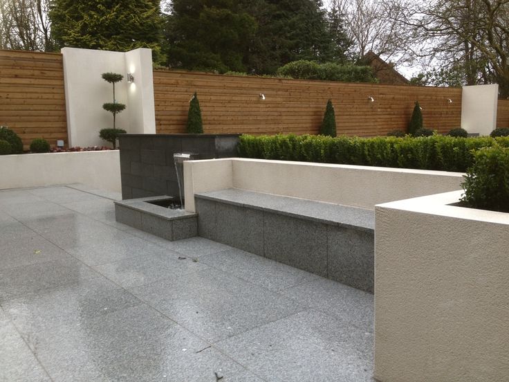 Rubies counteract poisons and sadness, curb lust, drive away terrible dreams, enlighten the mind, keep the human body from dangers, warn about it in advance, becoming darker.
In India, rubies have always been the most revered magical stones. They were considered the best exponents of the fiery element.
Emerald
Since ancient times, certain healing properties have been attributed to emeralds. These stones help with insomnia, drive away bad dreams, treat various inflammations, burns, diabetes, heart pain, reduce fever, fight infections, help with bladder diseases, help treat psoriasis, lower blood pressure. They also serve as a recognized “cure” for eye diseases, help get rid of melancholy and madness. In the old days, these stones served as a good remedy for scorpion and snake bites. Emerald is considered a stone of wisdom, hope and composure. People believe that these stones attract wealth, give peace and pacify voluptuousness. It is believed that the emerald can even split if one of the spouses is unfaithful.
Since ancient times, emeralds have been very powerful talismans. They helped in philosophy and scientific research. They protected their owners from all evil spirits and the influence of evil spells, protected them on long trips. Also, these stones helped pregnant women bear and safely give birth to a child.
Aquamarine
Indian yogis consider aquamarine to be a stimulant for the throat chakra, which governs emotions and is associated with the thyroid gland. This stone is able to strengthen the body’s defenses. It helps with various diseases of the skin and lungs, relieves toothache, has a beneficial effect on the stomach and liver, and alleviates allergic reactions. It is believed that aquamarines help their owners cope with seasickness.
In Tibetan and Mongolian medicine, aquamarines are considered good biostimulants and stabilizers of mental balance. They help to relieve nervous tension and find peace of mind. Aquamarines protect their owners from deceit and danger, strengthen spirituality and impart prudence. These stones cool violent emotions, quench irritation and anger, help relieve fears and stress. It is not recommended to wear aquamarines to dishonest people, as they can be quickly exposed. In the East, it has long been believed that aquamarines change color depending on the mood of the owner and the state of the atmosphere. Only in clear weather and when the owner has peace and tranquility in his soul, the stone is pure blue. During bad weather, it turns green and becomes cloudy. It also changes its color when its owner is worried or sad about something.
Aquamarine is a talisman for naval commanders and an amulet for sailors. It is also considered a stone of friendship, courage and justice.
Topaz
In ancient India, topaz was considered one of the twelve most important gems with strong healing properties. This stone is not once mentioned in the texts of Ayurveda. Topazes protect against colds, treat the digestive organs, gallbladder, spleen, liver. They help with severe nervous exhaustion and insomnia, relieve stress, strengthen the immune system, protect against various mental illnesses, exacerbate taste sensations.
In the Middle Ages, topaz was considered the best remedy for poisoning, as a change in its color indicated the presence of poison in food or drink. Therefore, it is not at all surprising that goblets were decorated with topaz. It is also believed that people wearing topaz are always optimistic and able to enjoy life. Topazes are called stones of inner enlightenment. They bring wisdom to men, and beauty to women. These stones drive away hatred and anger. Topazes are able to wave vague fears, attract material wealth. They also help to focus, successfully fight depression, eliminate doubts and anger. Indian yogis considered topaz stimulators of the highest chakra – Sahasrara. They used them in meditation. In magic, topaz is considered a precious stone-talisman that can protect against the evil eye and any witchcraft, as well as an amulet from all sorts of informational negative influences.
Amethyst
This stone is able to influence the Ajan chakra. Contemplation of amethysts brings calm and relieves strong nervous tension. And the water in which the amethyst lay is able to restore cerebral circulation. This stone protects against intoxication, wrinkles are smoothed out, freckles are reduced, nervous disorders and burns are treated. It is believed that an amethyst worn on the ring finger of the right hand will strengthen the immune system, and worn in earrings will help improve eyesight.
Amethyst is a stone of purity and purity. In India, amethysts were one of the strongest magical stones. It is believed that they initiate the opening of the “third eye”. Healing violet light, amethysts extinguish anxiety and mental pain, purify and soothe thoughts, fill the aura of its owner with good intentions and positive energy, and help control emotions. Amethyst is a stone of love, it is customary to give it to your loved ones. Amethyst in the shape of a heart, set in silver, has long been considered the best gift for a groom from his bride. Such a talisman brings peace and happiness to the newlyweds for many years. According to popular belief, amethysts give people insight and help control evil thoughts. It is believed that an amethyst ring can bring good luck in various sports. However, amethyst shows its power if it is worn not constantly, but from time to time. This stone is very suitable for travel lovers, as its color change during the day portends very strong winds and storms. As talismans, amethysts serve as protection against the discontent and anger of high-ranking officials. They are also amulets against drunkenness. If an amethyst jewelry is placed under the pillow, then this will help to see only good dreams.
Rock crystal
This mineral is able to improve the activity of the gallbladder, have a calming effect, increase the amount of milk in lactating women, helps with chronic and acute liver diseases with jaundice. In Mongolia, China and Ancient Tibet, crystal balls were applied to wounds so that the rays of the sun fell on the affected area through the stone. Thus the wounds were healed. Modern scientists have uncovered the secret of these miraculous healings. The fact is that when passing through this crystal, ultraviolet rays killed bacteria, which contributed to a quick cure. Rock crystal spells have an effect on animals, healing their diseases. It is believed that natural crystal is able to stabilize the physical and spiritual strength of a person, contributes to the fruitful work of the brain and spinal cord, helps with respiratory diseases, varicose veins and coronary disease, relieves headaches, helps to cope with stress and brings down high temperature.
The crystal ball is a frequent attribute of soothsayers and magicians who are able to see the future and the past in it, get answers to various questions, and summon spirits. It is believed that rock crystal perfectly concentrates attention, sharpens various thought processes and improves speech, and also gives its owners the gift of clairvoyance.
Natural rock crystal plays a special role in Tibetan and Indian medicine. It is believed that its energy can easily be tuned to the purity of human vibrations, regulate and stabilize them. Crystal balls were used by Tibetan lamas to open the “third eye”. They call rock crystal crystals “living”, because their 6 faces symbolize the 6 chakras of a person, converging to their top – to the seventh chakra directed upwards into the Cosmos.
Rock crystals are also used as talismans. They attract to their owner the joy of life, love, good luck, the sympathy of others, well-being and spiritual comfort. Rock crystal has also been a powerful hunting talisman since ancient times. He was considered a living being and was fed by dipping in the blood of various sacrificial animals. If you put this stone under your pillow, then it can get rid of insomnia, nightmares and causeless fears.
It is impossible to tell in detail about the wonderful properties of half of the stones in one article. Therefore, in order not to bore you too much, I will keep it short. As they say, a little about a lot.
Aventurine – maintains good spirits, happy, joyful mood and clarity of mind. This stone is considered the patron saint of travelers.
Agate – provides longevity and health, gives eloquence and strength. Sharpens eyesight, saves from poisons, is a talisman against accidents and accidents.
Amazonite – rejuvenates, strengthens the heart muscle, helps with rheumatism and arthritis, improves skin color.
Amethyst or purple quartz is a good gift for your loved ones. Saves from inflammation of the eyes and leprosy. It is considered the patron of longevity, family happiness and sobriety.
Beryl (golden yellow heliodor, blue aquamarine, green emerald) – can help with colds, severe back pain, improve metabolism.
Turquoise – heals diseases of the stomach and eyes, protects its owner from poverty, providing him with well-being and success. It is able to relieve headaches, reconcile enmity and anger.
Gagat – facilitates childbirth, prevents convulsions, increases blood pressure, reduces pain in gout.
Hematite – able to protect against poison, contagious diseases and suffocation, stabilize blood pressure. It is considered the patron saint of artists and business people.
Pomegranate – protects from the evil eye, extinguishes outbursts of anger, heals wounds. It is considered a stone of noble ladies.
Jade – relieves stress, protects from trouble.
Pearl – bestows health on women. Useful for cholelithiasis, conjunctivitis and hypertension.
Serpentine – protects the house of its owner from unkind people and any evil spirits.
Quartz hairy – able to ward off sadness, endows its owner with the ability to predict the future, is an excellent amulet in matters of the heart. Brings wealth and prosperity to the house.
Coral – improves memory and activates metabolism. He is able to neutralize envy and anger.
Lapis lazuli – improves sleep, calms the nervous system. Considered the patron saint of the winter months.
Moonstone – able to soften too self-confident and adamant people. It is considered a symbol of dreams.
Malachite – is considered a children’s talisman that gives health and protects from fear.
Morion (or black quartz) – is able to have a beneficial effect on the musculoskeletal system, helps in getting rid of drug addiction, as well as in the treatment of heart attacks and strokes.
Jade – able to heal kidney diseases.
Obsidian – protects from evil spirits, removes damage.
Onyx – able to get rid of irritations and vile passions. It is considered a stone of good mood.
Opal – eliminates melancholy and sadness, calms the heart and nerves.
Mother-of-pearl – able to have a strengthening and stimulating effect on the body.
Rauchtopaz (or smoky quartz) – is considered the most “energy” stone, able to relieve irritability, protect the owner from damage and the evil eye.
Rhodonite – can help with liver diseases and improve eyesight.
Rose quartz – is considered a children’s amulet, able to treat eye diseases.
Carnelian – causes sympathy and love, gives courage, protects from disputes and quarrels, eliminates various nervous diseases. Considered the patron saint of motherhood.
Tiger’s eye (bull, falcon, cat) – protects its owner from any trouble. Protects from betrayal, damage and the evil eye, saves love. It also protects against bad dreams. It is considered a stone of wealth.
Tourmaline – is able to strengthen the immune system, have a beneficial effect on the immune and lymphatic systems of a person, remove negative energy. Tourmaline is also called the “stone of restful sleep.”
Fluorite – is able to increase the analytical abilities of its owner, helps him streamline his thoughts.
Chrysolite (or olivine) is a friend of entrepreneurs and merchants, able to heal stomach pains.
Chrysoprase – is considered a stone of successful businessmen, is able to attract admirers to women and protect them from unrest.
Zircon is a good amulet for travelers and merchants. It inspires optimism and good spirits in its owner.
Citrine (or yellow quartz) – gives good luck to people born under the sign of “Leo”, while others help to cure diseases associated with metabolism.
Charoite – protects against radiation, is considered a real “energy wand”.
Spinel is the most powerful stimulant of passion and love, nourishing its owner with vitality, able to rejuvenate the body.
Shungite – treats allergies, joints, skin diseases, burns, purifies water well.
Amber is a good remedy for fever, tonsillitis, goiter.
Jasper – cleanses the body of its owner from toxins, treats stomach diseases and nervous disorders.
In conclusion, I would like to tell you about the work of one talisman. I recently found out about this, and for some reason I wanted to tell you this particular story, although there are many others that confirm the power of talisman stones.
One young man was convinced by his own example of the action of the Tiger’s eye, which was his amulet. This stone is considered a very good amulet that takes on negative energy. And Tiger’s Eye just loves money. The stone strongly begins to attract them and does not like to part with them. Somehow this young man went to an ATM to withdraw money and repay a debt to his friend. When it was his turn, this ATM suddenly broke down. Then the guy went to the bank. Came, and the bank does not work.
Stones have the ability to accumulate information. For many years they may not manifest themselves in any way and store their forces in themselves. It is very important to be able to customize your stone just for yourself. Many stones show their properties much stronger if you inherited them.
Bharhut Yavana
Bharhut Yavana
Bharhut Yavana is a high relief of a warrior that was discovered among the reliefs of the enclosure around the Bharhut stupa. It dates from around 100 BC, with a range of 150 to 80 BC. The relief is currently in the Indian Museum, Kolkata. The man in the relief was described as a Greek, who was called “Yavanas” by the Indians.
CONTENT
-
1 Characteristics
- 1.1 Lettering
- 2 Other cases of foreigners in Indian temples
- 3 links
Characteristics
The role of the standing warrior is the role of the dvarapala, the deities who were the Guardians of the temple gates.
Bharhut Yavana with details.
Portrait of the Indo-Greek king Menander.
Many elements indicate that this is a depiction of a foreigner and possibly an Indo-Greek, who was called Yavana by the Indians of that period. Elements leading to this suggestion are the coiffure (short curly hairstyle without the Indian turban), the hairband commonly worn by Indo-Greek kings on their coins, tunic and boots. In his right hand he holds a grape plant, possibly a symbol of his origin. The scabbard of his broadsword is adorned with a Srivasta or Nandipada, the symbols of Buddhism.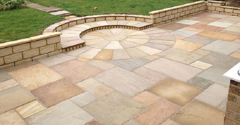
In his right hand he holds a vine, which could also be ivy.
This type of head, with the armband of a Greek king, can also be seen on reliefs at Sanchi, where a man in northern dress is depicted riding horned and winged lions.
It has been suggested that the warrior is actually the Indo-Greek king Menander who may have conquered Indian territory as far as Pataliputra and is known to have converted to Buddhism through Milinda Panha.
Lettering
The inscription above, classified as Inscription 55 in the railing posts of the southeast quadrant at Bharhuta (Bharhuta Stupa, Cunningham, p. 136 [1] ), is in Brahmi script and reads from left to right:
Inscription 55 on railing posts of the SW quadrant at Bharhut.
“Bhadanta Mahilasa thabho danam”
“The Pillar-Gift of the Lay Brother Mahila”.
- Bharhut Yavana inscription
Other cases of foreigners in Indian temples
Apart from this relief in Bharhuta, devotees in Greek dress also appear next to the Buddhist stupa of Sanchi.
Some of them seem to dedicate themselves to the South Gate of the Great Stupa. The official notice in Sanchi reads: “Foreigners worship the Stupa.” The relief shows 18 of these foreigners and 4 Gandharva celestial deities in the sky above them.
They have been called “Greek-looking foreigners” wearing Greek complete clothing with a tunic, cape and sandal, typical of Greek travel costume, and using Greek and Central Asian musical instruments (double aulos flute or carnyx-like Root Horn), perhaps pointing to the Indo-Greeks. The men are depicted with short, curly hair, often held back with a headband typical of Greek coins.
Three inscriptions are known from yavana donors in Sanchi, the clearest of which reads: “ Setapathiyasa yonasa danam ” (“Gift of Yona Setapatha”), Setapatha is an indeterminate city.
It is known that around 113 B.C. Heliodorus, an ambassador of the Indo-Greek ruler Antialcides, dedicated a column, the Heliodorus Column, about 5 miles from Sanchi, in the village of Vidisha.
| Northwestern foreigners in Sanchi |
Federal Agency for Subsoil Use : NEWS : 150 years since the birth of Vladimir Prokhorovich Amalitsky The main work of the geologist Vladimir Prokhorovich Amalitsky was the study of the life of the continents of the distant past. Vladimir Prokhorovich Amalitsky was born on July 13, 1860 in the village of Stariki, Volyn province. V.P. Amalitsky’s father died early, when the boy was only 3 years old, and his mother, after the death of her husband, was left almost without a livelihood. Her brother, the St. Petersburg doctor Polubinsky, took an active part in the fate of little Vladimir. After graduating from the gymnasium, V.P.Amalitsky entered the Faculty of Physics and Mathematics of St. Petersburg University, which at that time united all the natural sciences. Already in his second year, he chose geology as his specialty, headed at the university by two prominent scientists – V.V. Dokuchaev and A.A. Inostrantsev. Dokuchaev drew attention to a lively, very hardworking young student. In the third year, he even entrusted V.P. Amalitsky to conduct practical classes in crystallography. In 1883, V.P.Amalitsky graduated from the university with a PhD degree and was left at the department. At the same time, he received an offer from V.V. Dokuchaev to participate in a large expedition led by him to explore the lands of the Nizhny Novgorod province. At the time of V.P. Amalitsky, this feature of the distribution of fossil animal remains in continental rocks was not known. The absence of fossils was explained by the fact that these rocks were allegedly deposited in conditions unsuitable for life – in deserts, in dead lakes, etc. Continental strata were called “dead”, “lifeless”, “silent”. The absence of fossil animals made it impossible for the geologist to determine the age of continental rocks, nor to determine the conditions under which these sediments formed. Geologists usually avoided studying continental deposits, finding them uninteresting, not promising important scientific data, although their mystery in terms of origin and age has repeatedly attracted the attention of researchers. The wide distribution of continental Permian rocks in the north-east of European Russia amazed the young VP Amalitsky. His mind could not reconcile himself with the established opinion about the dead, lifeless nature of the formation of sediments over such large spaces, although the famous founder of the Permian system Murchison himself, after him Keyserling and others, could not find fossils here. V.P. Amalitsky found many shells of freshwater mollusks – anthracosides, related to modern river toothless. “Silent”, “dead” deposits “spoke”. VP Amalitsky turns from a geologist into a paleontologist. He subjects the remains he found to a detailed study, compares them with finds described earlier in other countries. Based on the fauna processed by him, he establishes the age of the “silent” variegated rocks, attributing them to the Permian system. The material collected by V.P. Amalitsky during the expedition gradually took shape in a major work “Deposits of the Permian system of the Oka-Volga basin” – his master’s thesis. In 1887, VP Amalitsky became a master of geology and curator of the Geological Cabinet of St. Petersburg University. In 1889He began his many years of teaching activity by giving a course in paleontology at the same university. The next year, V.P. Amalitsky received the chair of geology at the University of Warsaw. With his usual energy, he reorganized the geological study, introduced as a rule constant excursions with students in the vicinity of Warsaw to practically illustrate his lectures, created a scientific circle, and revived the activities of the Warsaw Society of Naturalists. In the very first year, the young professor became a favorite of students, popular in the scientific community of Warsaw. VP Amalitsky did not stop his research work. He made a trip to the Vologda and Olonets provinces to expand his previous research in the Nizhny Novgorod province; continues the study of fossil mollusks – anthracoside. V.P. Amalitsky discovered a remarkable feature of the development of flora and fauna in the Permian era on the territory of Russia. In 1892, V.P.Amalitsky defended his dissertation for the degree of Doctor of Geognosy “Materials for the knowledge of the fauna of the Permian system of Russia” at St. Petersburg University. In it, he pointed out that the knowledge of our Upper Permian fossil fauna can be completed only by comparison with the fauna of the southern continents, and not with the remains from the deposits of European countries. To accomplish this task, V.P. Amalitsky in 1894 left for England. There he worked extensively at the British Museum, studying the fossil fauna of the continental deposits of Karroo (South Africa) and Gondwana (India). VP Amalitsky predicted that the Upper Permian deposits of Russia should also contain remains of animal-like reptiles similar to South African ones. VP Amalitsky’s statements seemed fantastic to his contemporaries. They represented the complete opposite of the established opinion about the sharp difference between animals and plants on the northern and southern continents in the era of Perm. It seemed unbelievable that far to the north, in the center of the northern Permian continental region, suddenly there would be fauna and flora typical of the southern hemisphere. V.P.Amalitsky drew up a program of his research, presented it to the Warsaw Society of Naturalists and immediately began to implement it at his own expense. Starting from 1895 to 1898, V.P. Amalitsky sailed along the rivers Sukhona, Sev. Dvina and Vytegra, carefully examining all outcrops of Permian rocks. He published the results of summer observations annually under the general title “Geological Excursion to the North of Russia”. The year 1895 did not bring decisive evidence to V.P. Sukhona. Returning from his expedition at the end of the summer of 1895, V.P. Amalitsky unexpectedly discovered that, in addition to pebbles, sandstone also contains dense rolled bone fragments of the same dark brown color as pebbles. Diligent searches gave an encouraging result: several vertebrae, fragments of skulls and teeth were collected. The remains turned out to be similar to special representatives of animal-like reptiles – dicynodonts, very common in the Permian of South Africa. This discovery greatly encouraged V.P. Amalitsky. He returned to Warsaw and eagerly awaited the following summer, in order to once again set off in search of the precious remnants of ancient life, lost in the masses of “silent” variegated rocks on the banks of the rivers of the North. He decided to devote himself entirely to the study of continental deposits. In 1896, V.P. Amalitsky found new paleontological remains on the Sukhona River and at the confluence of the Yug and Northern Dvina rivers – imprints of leaves of true glossopteris, anthracosid shells and bone fragments of reptiles of the South African theromorph type. By the next year, the number of finds of the Permian fauna increased. On the Northern Dvina, V.P. Amalitsky discovered among the variegated clays huge lenses of loose sands containing hard sandstone concretions, the so-called concretions. In search of fauna, V.P. Amalitsky killed so many nodules that, in his words, “the resulting rubble would be enough for a large section of a good highway.” However, in several concretions there were imprints of leaves of excellent preservation. These leaves belonged to a glossopteris, quite indistinguishable from those found in abundance in South Africa. At the International Geological Congress in St. Petersburg in 1897, V.P. Amalitsky made a report on his work and presented the remains of flora and reptile bones found by him. Among the foreign delegates who arrived were prominent researchers of the Permian fauna of South Africa (Seeley, Seward, Peyler), who recognized the correctness of V.P. Amalitsky and supported his ideas. In 1898, V.P.Amalitsky found in concretions the largest lens of the Sokolki sands on the Malaya Northern Dvina, near the village of Efimovskaya, near the mountains. Kotlas, many excellent impressions of glossopteris leaves, and the jaw of an animal-like reptile with well-preserved teeth. The animal turned out to be a large herbivorous reptile – a pareiasaur. Until now, pareiasaurs were known only from the Permian deposits of South Africa and were considered the most typical representatives of the South African Permian fauna. At a meeting of the St. Petersburg Society of Naturalists, V.P. Amalitsky demonstrated his findings and immediately submitted a memorandum on the need for excavations in the Sokolka lens. The attitude of scientists to the ideas of V.P. Amalitsky immediately changed. The necessary funds were allocated for the excavations. In 1899, V.P.Amalitsky came across a large concretion containing a complete pareiasaurus skull, followed by a number of concretions. The unprecedented success of V.P.Amalitsky’s excavations amazed scientists all over the world. Together with excavations, preparation and study of his collections, V.P. Amalitsky continued geological observations on the Malaya Northern Dvina and discovered several more localities of terrestrial vertebrates (Zavrazhye, Boltyanskaya, Empty, Savvatia, Aristov, Kuzevo, Golodaevo, etc. In 1908 he was elected director of the Warsaw Polytechnic Institute. In the same year, V.P. Amalitsky decided to transfer all geological collections to the Academy of Sciences, having previously achieved an agreement between the St. Petersburg Society of Naturalists and the Academy of Sciences. Under this agreement, the Academy was supposed to accept and transport all collections to its Geological Museum and take over the continuation of excavations, the manufacture of display cases for skeletons, and also provide the necessary premises for the exhibition. Continuation of work, storage and scientific processing of the collections should have been entrusted to V. VP Amalitsky tried to set up the Warsaw Polytechnic Institute in Moscow, but failed. Then he moved with the institute and with all his collections to Nizhny Novgorod, where in 1916 he tried to establish scientific and pedagogical work. However, V.P. Amalitsky fell seriously ill and was sent to Kislovodsk for treatment. December 28, 1917 Vladimir Prokhorovich Amalitsky died in Kislovodsk at the age of 57. So early ended the life of Vladimir Prokhorovich Amalitsky, full of work, multifaceted activity on new paths for science. Rosnedra Press Service Gwalior Castle, fort and principality in IndiaThere is a beautiful legend about the origin of Gwalior. The sage Gwalipa lived on one of the hills, and one day Prince Suraj Sen came to the same hill. The sage Gwalipa met the prince and offered the traveler water from the reservoir. After drinking the water, the prince was miraculously cured of leprosy and promised the sage to fulfill any of his requests. The sage did not want anything for himself, but only asked to save the source of miraculous water. Surge Sen kept his word and on 9A handsome fort grew up on a 0-meter hill, which was given the name Gwalior, and today the source is still protected by the old walls of the fort. The sage Gwalipa said that the power will be in the hands of this dynasty until the next prince calls his heir Pal. All this happened eighty-three times, but the next ruler gave the child a different name. Thus, power, together with the principality, was lost to this dynasty forever. HistoryGwalior Fort Gwalior has always played an important role in the history of North India as the political center of the historical region of Malwa. Gwalior was originally called the fortress, which was built in the middle of the 10th century. The existence of this fortress at the crossroads of the most important trade routes was known as early as the 6th century. In 1232, after a long siege that lasted almost a year, the fortress was captured by the Delhi sultan Shams ad-Din. The Rajputs defending the fortress committed collective suicide with women and children. In 1398, Gwalior became the capital of the Rajput Tomar dynasty, most of the fortress and palaces were built in those days. 1518 and again a siege for a year. The fortress was captured by the Delhi Sultan Ibrahim Lodi. After there were the Great Mughals, and during the collapse of the Empire, the Maratha family of Sindhia felt comfortable here. All this continued until the coming of the British, after this momentous event the Maharajas of Gwalior became their vassals. The Principality was abolished only in 1948 and Gwalior became the capital of the state of Madhya Bharat, and since 1956 the regional center of the state of Madhya Pradesh. Outside the walls of the fortress, in good condition, you can find six palaces, six temples, a mosque, eight pools and monuments of Indian architecture of the XI century. At the western walls of the fortress in the 15th century, giant Jain statues were carved into the rock, reaching 18 meters in height. It is for the sake of the fort that tourists come here. According to the 2011 India Census, the population of Gwalior was 1,053,505. The city is large, noisy, dusty and uncomfortable, but all these shortcomings cannot overshadow the sights of Gwalior. Gwalior attractions on the mapGwalior attractions on the map Detailed Google map is here. Gwalior is not as complicated for a tourist as it seems. If you do not have much time, then you have a chance to see a lot in Gwalior. All the main attractions of Gwalior are concentrated near the fort or in it. Judge for yourself, if you are going to inspect the fort, whether you like it or not, you will have to walk from the city to the fort, which is located on a hundred-meter hill. But the difficulties of climbing are fully compensated, because along the way you yourself, without knowing it, see some of the sights. If you go up from the western entrance to the fort, you will see stone sculptures of 24 Jain gurus. If your path to the fort lies on the east side, then you will pass through a cascade of gates, which in themselves are monuments of medieval architecture, if you wish, you can immediately visit the Archaeological Museum, you will also see a whole string of small temples and all this on the way to the fort . Having risen to the fort, the first thing worth seeing is the Man Mandir Palace, it is for the sake of it that many tourists go to Gwalior. Next to the motley palace, there are simpler palaces and other ruins that are of historical value only for professionals. Paphos Jai Vilas Palace, built using prisoner slave labor, with a silver railroad laid on the dining table and other kitsch, you can see in the immediate vicinity of the fort, but it will not be close on foot, take a rickshaw. Gwalior FortThe fortress can be entered from two sides, the Eastern gate is colorful and ornate, and huge Jain statues adorn your path from the western side. East gate to the fortEast gate to Gwalior Fort If you want to see how the Middle Ages looks like, then head to Gwalior Fort exclusively through the east gate. Guidebooks say different things, but what you see will fascinate and amaze you. It is not for nothing that Gwalior Fort is considered one of the most beautiful forts in modern India. Arriving by any means of transport at the first gate to the fort, make sure that the driver brought you exactly where you asked, my experience shows that often tourists are taken by default to the western entrance to the fort. The very first gate to Gwalior Fort is called the Gwalior Gate (or Alamgiri Gate) built around 1660. There is no special beauty in them, so feel free to go inside to the third gate. Why third? Yes, because the second gate exists exclusively in history and once had the beautiful name Bansur (Bansur, Archer’s Gate). Once in a small square in front of the third gate with the name Badalgarh (Badalgarh), they are named after Badal Singh, uncle In this place, time seems to have stopped, the general shabby buildings, a parked human-drawn cart, local residents in clothes that are not very modern and long-tailed peacocks walking on the roof add surrealism. Surprisingly, peacocks can fly, otherwise how did they get so high. Going further, there will be a gate of Ganesh, built in the 15th century. Behind them is Kabutar Khan and not very interesting long-destroyed niches with Jain sculptures. You will also see a small Hindu temple with four pillars, dedicated to the hermit Gwalipa, after whom the fort and the city are named. If you are not an expert on the history of the Gwalior fort, then the probability of passing by all the marked buildings that are located after the gate of Ganesh is very high, this is exactly what happened to me. Buildings on the sides of the road, you take for granted and no longer pay much attention, all attention is switched to the imposing walls of the Man Mandir palace. In fact, the Elephant Gate is the last, but once there was a sixth gate, the HawaGate, it no longer exists and you have the entrance to the Gwalior Fort. From the Elephant Gate, a beautiful view of the colorful city blocks opens up, the view will be even better if you walk along the fortress wall of the fort. Huge Palace Man Mandir is impressive. Despite its impregnable appearance, the palace is decorated with bright tiles like a Christmas tree, and therefore its appearance is not formidable at all. You can enter the fort only through a small gate in the gate. The door is really small, for comparison, a local resident either got caught too tall, or the height of the doorway is no more than a meter. Here we are, the Man Mandir Palace in the rays of the setting sun, meets us with its yellow ducks and other living creatures on the facade. Looking back, you can clearly see how long the climb is, but thanks to the sights scattered along the way, the road is passed quickly. Western gate and sculptures of JainsWestern gates and sculptures of Jains At the station square I catch a rickshaw and for 50 rupees it rushes to the Gwalior fort. My mistake was that I did not indicate which gate I needed to be taken to, but the western entrance to the fort, to which I arrived, is also beautiful in its own way. Having made his way through all the traffic jams and traffic jams, the driver proudly said “fort there”, pointing to a winding road going up the hill. Having bought some water, I wandered up the mountain. The road winded and was fresh, when suddenly, behind one of the turns, Jain sculptures began to appear in bulk in the rocks. Sculptures depict 24 holy teachers of the Jain religion, the time of the creation of these ears dates back to the seventh – twelfth centuries of our era. The largest statue is 19 meters high. Jainism as a religion was founded by Sri Mahavira (twenty-fourth Tirtankara) around 599 to 527 BC. Religion is based on five ethical principles: do no harm to any living being, be sincere and pious, neither steal, nor commit adultery, nor acquire. Since all Jains cannot engage in fishing (outright killing), agriculture (you can harm living organisms that are in the ground) and cattle breeding, the most common occupations for Jains are trade, usury and jewelry. In 1527, Muslim admirers of other forms in sculpture, under the leadership of Babur, beat off the faces and some other protruding parts of the bodies of most of the sculptures, but in our time some sculptures have been restored, the faces have been restored, and the fact that they have not become lower may not be the time yet . The leader of the Muslim raid of 1527, Babur, even made notes in his diary about the Jain sculptures of Gwalior: “They worked hard rock and carved idols from it, the size of about 20 gas (13 meters). The road led up the hill, the sculptures ended and the gate to the Gwalior fort is already visible. For everyone who enters the Gwalior Fort from the west side, the picture is something like the following, you are brought to the lower gate, which is called Urvai and indicates the direction of movement. On the winding and rather steep road, you are met by Jain giants, carved into the rock as far back as the fifth century. Passing through the Jain sculptures, you see another gate and the inner fort wall. The construction of the fort was started by Suraj Sen, there is even a beautiful legend about it. Over time, different rulers completed the construction of palaces, courtyards, balconies, underground chambers, temples decorated with sculptures, mosques, gardens, fountains, wells and reservoirs. The architecture and sculpture of the fort contains elements brought by the Hindus, Jains, Muslims and the British, which are scattered throughout the fort. Once inside, the ascent to the hill continues and seems to be forever. This is not surprising, the Gwalior fort is over three kilometers long, and in its widest part it has almost a kilometer. But after passing through a narrow passage along the walls immersed in greenery in front of you is a crossroads and a choice of several paths. If you go straight, then on your way there will be a local village, and immediately behind it is a cluster of palaces and temples. Entering a special gate, it protects the old palaces from penetration into the territory of sacred animals, on the left hand side there is a small Hindu temple of the 16th century Vikram Mandir with open walls, which was destroyed during the First World War. Sculptures and other artefacts are publicly displayed in the courtyard of the temple, but the temple itself looks very modest. The road leading to the colorful palace of Man Mandir offers to test local snacks, at the same time you will find out how strong your stomach is. The food in the fort is not very good, I did not find restaurants and full-fledged cafes, but there are tents that sell tea and cookies. Man Mandir Palace is perhaps the most memorable object in Gwalior Fort, it is surrounded by other palaces, temples, wells and other structures without which no fort in India can do. Man Mandir Palace in GwaliorMan Mandir Palace in Gwalior The true highlight of the old fort in Gwalior, which attracts tourists from all over the world, is the majestic Man Mandir Palace. The time of construction of the palace is in the interval from 1486 to 1517. Like something out of a children’s fairy tale, the palace looks more like a jewelry box than a defensive structure. Walls lined with tiles, on which ducks, crocodiles and other animals are colorfully depicted, evoke childhood memories of oriental tales. Man Mandir Palace is built in the form of semicircular domes and towers, they harmoniously merge into part of the fort wall and are a continuation of the hill on which the fort stands. The first Mughal Emperor Babur, who visited the Man Mandir Palace 20 years after its construction, made notes about it. He wrote that the stone walls of the palace were entirely covered with white plaster, the domes of gilded copper shone in the sun, and the outer walls were inlaid with painted tiles. The stone slabs of the cladding are intricately carved in the form of several ribbons that stretch along the walls, wrap around the columns, and then descend as flower pendants from the consoles and ceiling. Inside the palace, everything is quite ascetic, but there are several rooms with beautiful carved window bars, behind which women from the harem gathered to listen to the court musicians. Two roads lead to the palace, the first is straight through the Elephant Gate, through which the Maharajas on elephants were heading out of the fort. Near the gate, a unique covered gazebo has been preserved, from which they walked on the back of an elephant. The second road stretches through the entire fort and descends into the city through the western gate of Urvai. Man Mandir Palace has several underground floors, during the Mughal times, the underground floors were used as a prison for their unfortunate relatives. It was there that Emperor Aurangzeb imprisoned his brother, whom he later executed here. But this is not the only horror story about Man Mandir. Surprised by such impudence, the Maharaja insisted on his own, but the girl put forward a number of conditions. Firstly, she agrees to enter the palace exclusively as a wife, and secondly, she always wanted to be with him and one more small wish of a modest village girl. All that was required was to build a palace for her with a pool filled with lake water from her village. All conditions were met, but happiness did not last long. In the next military campaign in which the forces were clearly unequal and the outcome of the confrontation was known in advance. In order not to be captured, the women from the harem performed the Jokhar rite. The wives entered their favorite round room of the palace for the last time and lit a huge fire at the bottom of the empty pool, in which they ended their earthly journey. And the ambitious village girl, who always wanted to be with her master, was with him in the last moments of his life. Maharaja fulfilled his promise, always and everywhere they were together. She, weapons in hand, shoulder to shoulder, fought alongside her beloved. This is how they met their death. I believe that this legend in its tragedy is in no way inferior to the one about Mumtaz and the Taj Mahal. In India, every fort has stories that make the blood run cold, but this makes visiting such places even more exciting and interesting. Moving further north through the fort, the palaces and ancient buildings continue. The state of most of them is sad, but quite suitable for inspection. Everywhere there are signs saying that this building was protected as being of historical value, but there are few signs that would tell about the building itself and its history. Walls of palaces blackened by time, deserted courtyards and silence bring a mystical mood of the walk. There are buildings for different purposes and, accordingly, of different beauty, some are elegant, others are more like a barn or barracks. An amazing architectural solution was used by the builders of the palace, two gates, but for whom is this door no more than half a meter high? The interior decoration of the palaces is simple and functional, in the courtyards of many palaces there is always a well or a pond. With reservoirs near the Gwalior Fort, there is a separate story. In the palace I saw an altar with a Shiva Lingam, but why are there Tibetan flags above the altar? Gwalior Fort, does not immediately open its best views, sometimes it is worth walking several times along the same path and each time the picture changes, the setting sun may be to blame, decorating the ancient walls in warm colors. If you continue to explore the fort in a southeasterly direction, you will definitely come across the Suraj Kund reservoir. On the same road, a little further on, is the gurudwara Data Bandhi Chod. The majestic white marble temple was erected in honor of the famous sixth guru Har Gobind, imprisoned for two years by Emperor Jahangir. Sikh TempleSikh Temple The temple is modern and was built in modern times in honor of the sixth Sikh guru named Har Gobind, who was imprisoned in Man Singh’s palace from 1617 to 1619. Lined rows of palm trees lead to the entrance to the Data Bandhi Chod gurudwara. Everyone can visit the temple of white marble, observing simple rules: the head of the person who enters must be covered (if suddenly you don’t have a turban, then there are baskets with scarves in front of the temple :)), feet must be without shoes, before entering the territory of the temple, you want it or no, you will wash them, because next to the steps leading to the territory, a reservoir with running water has been built, in order to enter inside it must be overcome. I have been to several Sikh temples and everywhere was very clean, despite the presence of crowds of tourists and parishioners, the temple in Gwalior fort also pleased me with cleanliness and order. If you have free time, look here, especially since it is located fifty meters from the famous reservoir Suraj Kund, according to legend, the water from which is healing. If you walk along the fortress wall from the Man Mandir Palace towards the western gate, then the probability of finding Sasbahu temples is high. Sasbahu temples are two Hindu temples dedicated to Vishnu and Shiva. Sasbahu TempleSasbahu Temple Everything that arouses human interest in India has its own legend. About the temples of Sasbahu, the legend says the following, the local maharaja had a family. The mother-in-law and daughter-in-law worshiped different gods (this is not uncommon in India), family happiness was hindered by conflicts on religious grounds between women. Approximate time of construction of temples dates back to IX-XI centuries AD. The larger and more beautiful temple is the Mother-in-Law Temple, dedicated to the god Vishnu. The “Temple of the Mother-in-Law” is multi-level, covered with several rows of friezes and sculptures on the outside, the inside of the temple is also beautiful – carved columns and ceilings, images of gods and mythical creatures cover every centimeter of stone. The smaller temple is the “Temple of the Daughter-in-Law”, dedicated to Shiva. It looks neater and has a well-preserved pyramidal roof, but the inside is poor, unlike the Mother-in-Law Temple. Walk along the fortress wallWalk along the fortress wall If you have time, be sure to climb the fortress wall and go around the fort. The Old Fort of Gwalior offers old palaces, mysterious temples and amazing water reservoirs. The best views and maximum freedom you will find if you head away from the paved hiking trails towards the walls of the Gwalior fort. Drive away embarrassment and climb into the first hole in the fence that caught your eye, because behind it is something that the guide will not show, behind it is not a sightseeing trail and a sea of emotions. Feel free to climb the “designer” steps, which are at least 500 years old. Gwalior is the second largest fort in India, the length of its walls exceeds 14 kilometers, 14 kilometers, which can tell you everything they saw. If you have never walked along the fortress wall of a medieval fort, located in the very center of a modern city with a population of under a million, then you will remember this walk for a long time. As in the Middle Ages, the walls still protect today, today you can not hear the city noise behind them and you can enjoy the silence and watch with curiosity how the eagles soar above your head. But the walls of the fort have also seen turbulent times, this is evidenced by the gaps in the wall that appear from time to time, through which the cacophony of the city flows at you, but after walking a few meters, you are again under the reliable protection of old stones. Walking along the very top of the wall is comfortable and a sense of calmness is the feeling that stone walls give several centuries thick, and far below there is a city with an ancient history and modern problems. The views of Gwalior from a height of a hundred meters are fascinating, its temples, palaces, tombs and slums are visible at a glance, such a picture was here long before your visit and will exist for many years after you. Walking along the wall from the east side, you see all the sights around the fort, to be more precise, all the sights are concentrated either in the fort itself or on the east side of it. At the very foot of the hill, Gujari Mahal is perfectly visible, this palace was built by Raja Man Singh for his wife at the end of the 15th century, now the Indians use it as an archaeological museum, which contains everything that was once located within the walls of the palaces of the fort. A little further away, from the height of the walls of the fort, one can distinguish the Alamgiri Gate and the magnificent Badalgarh Gate, named after Badal Singh, Man Singh’s uncle. The time of construction of which dates back to the end of the 15th century. And looking into the distance, you will see modern buildings that run like a motley carpet over the horizon. After walking a little more, palaces will begin to appear in front of you, one after another. The most significant bonus that you can get from walking along the eastern part of the wall is a fabulous view of the fabulous Man Mandir Palace. Words are powerless here, it must be seen. The next section of the fortress wall, suitable for walking, offers a bewitching view of the Hindu temples of Sasbahu, which are often called “Temples of mother-in-law and daughter-in-law”. From the western side of the fort, the views are simpler, but there are no people there, as they say, everything is at your disposal and you can safely observe the life below. Through the stone sight | PublicationsOn both sides of the road, the typical landscape of the South West of England: gloomy peat bogs, monotonous rolling countryside. And fog, whitish everywhere, even lilac fog dense, like cotton wool, wet and viscous. Everything seems familiar, although this is my first time here. Where does it come from, the feeling that it has already happened to me? Maybe Conan Doyle, The Hound of the Baskervilles? He recalled that Dr. Watson wrote to Holmes about this place: “The longer you live here, the more and more the gloom of these swamps begins to eat into your soul … As soon as I go out to them, I feel that modern England remains somewhere behind, and instead of it you see around only traces of the habitation and labors of prehistoric man. This long-vanished tribe reminds of itself everywhere there are caves, here are graves, here are huge boulders left where, apparently, their temples were. Ahead is a cluster of giant rocks. I wander between the rickety monoliths and listen to the whistle of the wind in the stone labyrinth in the middle of the plain. The fog dispersed. Everything is like a thousand years ago. Stonehenge is so ancient that its history has been forgotten since antiquity. Neither Greek nor Roman authors write anything about him. Probably, the Romans were not impressed at all by these stones, because they saw the ancient Egyptian pyramids, and they themselves built majestic temples. Today it is no longer possible to establish who was the first biographer of Stonehenge. Who built it? Following them (although God only knows how long these “followings” lasted!) appeared the “fir bolg” people, hard-working skilful farmers. “Fir bolg” is translated as “leather bags” on them they sailed to Ireland. There were also the Tuatha de Danann, the Milesians, the Dravidians from India. This is all that we managed to extract from those traditions that miraculously survived, despite the attempts of the Romans to impose their ideas about the past on the local tribes. Anyway, the population of Britain was small in those distant centuries. It was built between 1900 and 1600 BC and took as long to build as a Gothic cathedral, almost a century. The latter served only as a place of worship to God and monuments of the Christian faith. Having read the legends, you forget to ask the question how did they get here, these giant stones? In the name of what are such incredible efforts, such a blatant discrepancy between fragile human strength and multi-ton monoliths? However, similar questions arise when examining the Egyptian pyramids, and the stone idols of Easter Island, and the Cyclopean buildings of Zimbabwe. And in general, all the megalithic centers scattered along the coasts of the Mediterranean, Atlantic, Pacific Ocean. And yet, from where? Maybe the almighty Merlin put them here forever? Or, after all, the ancient inhabitants of the British Isles were not at all primitive savages, capable only of dancing, hunting and painting their bodies blue, but skillful builders, enterprising people, and most importantly, wise with rich experience … The stones are different to the touch: millennia have not been able to “comb” them, so the rocks were different? Indeed, the main building material of monoliths is dolerite, but there is also volcanic lava (rhyolite), and volcanic tuff, and sandstone, and calcareous tuff. They were transported on wooden sledges along logs, which were substituted instead of wheels. They pulled with ropes twisted from leather belts, harnessed in groups. Most likely, the wheel was not yet known here, although it had long been known in Egypt. An “investigative experiment” carried out by scientists at one time helped to find out that 24 people are able to drag a load weighing one ton a kilometer and a half a day in this way. On the water, the situation was simpler: several wooden canoes connected by boards could withstand huge weights and were easily controlled. But what about the heavier stones, sarsens? Their deposit was discovered much closer to Stonehenge, “only” 30 kilometers away. The weight of the largest “gray sheep” (as these blocks were called) reaches 50 tons. It is estimated that a thousand people delivered them to the construction site in seven years. The ancient craftsmen skillfully processed the blocks even before taking them to the construction site of the complex, using the technique of impact and working with fire and cold. After a crack was outlined on the stone, a fire was laid out on it, and then cold water was poured. And beaten with stone hammers. Scientists had to figure out how the giants were installed. It turned out that at first they dug holes, the length of which was equal to the length of that part of the stone that was supposed to be buried. The length and width of the hole was 90 centimeters larger than the stone. Three walls of the hole were made sheer, writes the English astronomer J. Hawkins, who published an interesting book on Stonehenge, and the fourth was given a slope of 45 degrees – that was the receiving ramp. Before placing a stone, the wall of the hole was lined with thick wooden stakes. The stone slid over it without breaking the ground. Then the colossus was placed vertically with the help of ropes and ropes. Quickly, quickly while those who held it had enough strength filled up the free space around, so long as the stone did not collapse! Having tamped, they left it alone for months, until the soil sags and compresses. An important detail: the lower ends of the vertical stones were beaten with a blunt cone so that after they were lowered into the hole, the stones could be turned and set more precisely. I trample under the canopy of giants, hiding behind rough boulders from the sun, shining un-spring hot. I look up and try to figure out how they ended up there, high above, multi-ton beams. They were not lifted there by helicopters. Although the thought of mysterious aliens, I confess, stubbornly does not leave me. But even an almighty druid was clearly unable to lift such a colossus using telekinesis … Maybe along earthen embankments? After all, it was this method that was proposed as a working hypothesis back in 1730 by the early explorer of Stonehenge S. Wallis. But the construction and dismantling of such an embankment for all 35 beams would require gigantic labor more than the work spent on the entire complex. In addition, the remains of earth embankments were not found, this version was left . What if they operated by the method of throwing with the help of piles of logs? Approximately like this: a stone crossbar was laid on the ground at the foot of its future supports, and then a layer of logs was laid perpendicular to it, it was rolled onto logs, and a double layer of logs was already laid in the place where it lay before, but already parallel and perpendicular . Back and forth, back and forth. And here is the stone roof at the very top. The last task was to transfer it to the prepared place and so that all its nests lay on the spikes of the support. It has been calculated: such a tower of longitudinal and transverse layers of wood would require 15 kilometers of logs with pre-cut grooves. And they also calculated: the construction of Stonehenge took three hundred years of work and thousands of workers, in total, one and a half million man-days of physical labor were spent. Now the last and main question what was all this for? On the day of the summer solstice, crowds of people gather at Stonehenge to watch the sunrise over the Heel Stone. Why did the ancients need it? Well, for sure, to predict the start time of sowing. Then the priests could arrange theatrical performances at the rising and setting of the sun and moon. …Stonehenge’s megaliths were slowly fading into the gray haze that had once again enveloped the valley, and I suddenly thought: five of the seven wonders of the world the Egyptian pyramids, the statue of Zeus at Olympia, the temple of Diana at Ephesus, the mausoleum at Halicarnassus, and the lighthouse of Alexandria on the island of Pharos were made of stone. London N. Nepomniachtchi our specialist. corr. SOUTH EAST ASIA CIVILIZATION | Encyclopedia Around the WorldContents of the article SOUTH EAST ASIA CIVILIZATION. South of China and east of India lies the peninsular and insular region of Southeast Asia, comprising Myanmar (Burma), Thailand, Indochina (Laos, Cambodia, Vietnam), Malaysia and Indonesia, as well as Brunei and Singapore. In this territory, in the first centuries of the new era, an original civilization grew up, giving rise to large cities, giant temples, complex irrigation systems, as well as vast powerful states. The civilization of Southeast Asia owes its origin and to a large extent its main features to the influence of India, in particular to Hinduism and Buddhism. Their impact was so strong that modern scholars call this civilization “Hindu-Buddhist.” See also HINDUISM; BUDDHA AND BUDDHISM. ORIGIN OF THE HINDU-BUDDHI CIVILIZATION History of Southeast Asia up to the 2nd c. AD remains a blind spot in science. The earliest information about it is contained in the Chinese written sources of that time and the finds of archaeologists. In Chinese dynastic chronicles, states are mentioned whose rulers bore Indian names in Sanskrit, and the clergy were representatives of the highest caste – the Brahmins. Buddha images of the same style as at Amaravati on the Krishna River in South India, characteristic of the period between 150 and 250 AD, have been found in Thailand, Cambodia and Annam (Central Vietnam), and on the islands of Java, Sumatra and Sulawesi. The earliest texts – in Sanskrit – have been found in West Java, East Kalimantan, northern Malaya and Cambodia. These inscriptions are written in an ancient alphabet from the time of the Pallavas, a Tamil dynasty that ruled from the 3rd to the 8th century. in Kanchipuram, southeast India. More recent times include evidence reflecting cultural influences from other parts of India. From the northeast came one of the branches of Buddhism – the Mahayana. It bore the imprint of the mystical, Hindu-influenced doctrine of Tantrism, which originated in the Buddhist monastery of Nalanda in Bihar. From the 11th century the authority of the Ceylon (Lankan) branch of Buddhism begins to affect. This branch of Buddhism – Hinayana (Theravada) – gradually replaced the Mahayana and Hinduism from Burma, Thailand, Cambodia and Laos. See also TANTRAS. The most ancient culture of Southeast Asia.The origin of the peoples of Southeast Asia. Little is known about the genesis and early migration of peoples who developed their own cultures under the influence of Hinduism and Buddhism. Material culture. The material well-being of the peoples of Southeast Asia was based on the cultivation of fruit trees, intensive cultivation of rice and fishing. There was also a “boat” civilizational culture, distinguished by an amazing variety of boats of different types and sizes used. Many families spent their lives on their boats, and until recently, communication between settlements in Southeast Asia was carried out mainly by water. Especially high art of navigation was possessed by the inhabitants of the coasts, who made long-distance sea voyages. Religion. Religion was a mixture of three elements: animalism, ancestor worship and worship of local gods of fertility. The water gods of fertility were especially revered in the form of a naga – a mythical cobra with several human heads. Penetration of Indian culture.The penetration of Hinduism and Buddhism into Southeast Asia, apparently, began even before the 2nd century BC. AD Hinduism was implanted by the rulers of local states, who sought to imitate the splendor of Indian courts. Buddhism was brought with them by mendicant Buddhist monks (bhiksu), who founded monasteries. The rulers who adopted Hinduism invited Indian brahmins to perform rituals of deification of monarchs by identifying them with one of the highest Hindu gods – Shiva, Vishnu or Harihara, (a deity that combines the features of the first two). The new names of the rulers often indicated the gods with whom they were identified (Isanavarman – “Shiva’s Favorite”, Indravarman – “Indra’s Favorite” and Jayavarman – “Favorite of Victory”). Gradually Sanskrit became the sacred court language. Over time, the Indian script was adapted for the first literary works in local languages. Excellent examples of this are the earliest extant inscriptions in Javanese, Malay, Mon and Khmer. To legitimize the rulers of Southeast Asia, the Brahmins used mythical images taken from the epic poems Ramayana and the Mahabharata, as well as from the Puranas (collections of religious myths and hymns) and other texts containing the mythical genealogy of the royal families of the Ganges region. Early Shaivite inscriptions indicate that the state religion was based on the cult of the royal linga (phallic symbol), which, as it was believed, concentrated the magical power of the god-king, which ensured the welfare of the state. Thus, the autochthonous fertility cult was dressed in Indian clothes EARLY INDUISE STATESFunan. The first royal courts under Indian influence, known to historians, appeared towards the end of the 2nd century. AD in three areas: a) in the Mekong Delta, b) on the coast of modern Vietnam, south of Hue, and c) in the north of Malaya. The name “Funan”, by which the state located in the Mekong Delta is known, is found in Chinese sources and is a derivative of the ancient Khmer word “mountain”. In the first half of the 3rd c. Funan developed into a powerful empire under the rule of a king whose name is mentioned in Chinese chronicles as Fang Shiman. The ships of this monarch dominated the seas, and the states on the lands of the lower reaches of the Mekong up to the northern regions of the Malay Peninsula were his vassals. Like Rome in Europe, Funan left many elements of its culture as a legacy to the states that succeeded it, but in the middle of the 6th century. under the pressure of the Khmers gaining strength, the influence of Funan itself is waning. The Chinese called the Khmer state Chenla and reported that at first it was a vassal of Funan. No explanation for this name has been found. During the century preceding the accession to the throne of the Khmer king Jayavarman II in 802, Chinese sources mention two states: Chenla of the Earth and Chenla of the Water. Thiampa (Champa).The historical Vietnamese region of Annam is rich in archaeological sites of the people known as Cham (Cham). For the first time in history, they are mentioned as lin-i in the reports of the Chinese governor to the north of Nam Viet: a high-ranking official complained about the raids of the Chams. Until now, it remains unclear how Indian trends penetrated them. The earliest inscriptions, dated c. 400 AD, testify to the fact that their court religion was Shaivism. One of the inscriptions is related to the most ancient linga discovered in Southeast Asia. The early history of the Chams is a continuous series of attempts to expand northward by both land and sea routes, which forced the Chinese to undertake punitive expeditions against them. The Vietnamese at that time inhabited the lands, the border of which in the south only slightly extended beyond the Tonkin region, which occupies the northern part of modern Vietnam. States in the Malay Peninsula.Scanty information about these states is available in Chinese sources. More valuable information is contained in inscriptions made in the most ancient Pallavic script, the earliest of which date back to the end of the 4th century BC. Early Indonesian states. The earliest Java inscriptions known to us date back to about 450. They were made by the king of Taruma in West Java, Purnavarman, who began the construction of irrigation systems and erected a temple dedicated to the god Vishnu. In the east of Kalimantan, in the Kutei region, on the Mahakam River, dating back to the beginning of the 5th century were found. inscriptions of a certain king Mulavarman, but nothing is known about the further fate of his state. Inscriptions in Myanmar and Thailand. There is evidence that from the middle of the 4th c. in Arakan, on the western coast of Burma (Myanmar), north of the delta of the Irrawaddy River, the Chandra dynasty ruled, but this information is known only from inscriptions of a later period. At Shrikshetra, near present-day Pyu (Proma), in Central Myanmar, inscriptions have been found that probably date back to 500. Shrikshetra was the capital of the state of the Pyu people, who are believed to have been the vanguard of the Burmese (Myanmar) migrating into the country. The Pyu occupied the Irrawaddy valley as far north as Khalinji, near present-day Shuebo. To the east of them, from Chaushe to present-day Molamyine in the south, and in the Irrawaddy Valley, were the states of the Mons Pegu and Thaton. The Mons also inhabited the Menama Chao Phraya Valley (Thailand). The earliest discovered Mon inscriptions date back to about 600. Rise of the state of Srivijaya. After the fall of Funan in the 6th c. its place was taken by Srivijaya, which developed around Palembang, in the southeast of Sumatra. This vast trading empire owed its prosperity to the control of the Straits of Malacca and Sunda, as well as to the goodwill of China, where it sent numerous embassies. Srivijaya existed from the 7th to the 13th century. She did not leave behind such monumental monuments as are found in Central Java, but Palembang has long been an important center of education for the Mahayanists. In 671, in order to study Sanskrit grammar, he was visited by the Chinese Buddhist monk I Ching, who then went to India. THE ERA OF TEMPLE BUILDERS In the period from 650 to 1250, wonderful works of art and architecture were created in the states of Southeast Asia, in no way inferior to the best world examples. Among the Chams, this flourishing in the artistic sphere began in the middle of the 7th century, when the Tang dynasty in China stopped the expansion of Tyampa to the north for a long time. Very little is known about significant changes in the lower Mekong region since the Khmer conquest of Funan. Sufficiently complete and reliable information on the history of this territory appears only from the time of the founding of the Khmer capital on the northern shore of Lake Sap (or Tonle Sap – “Great Lake”), founded in 802 by King Jayavarman II. Javanese kingdoms. The historical information we have about these kingdoms is often inaccurate. The development of the art of Central Java was associated with two local dynasties: the Mahayanist Shailendra and the Shaivite Sanjaya. Information about these dynasties until the 8th c. missing. In Sanskrit, Shailendra means “king of the mountain”, and it is possible that this indicates the connection of the dynasty with the “kings of the mountain” of Funani of an earlier period. Under Shailendra, wonderful Buddhist monuments and temple complexes were erected, of which the most impressive are the huge Borobudur ensemble and the Chandi (Hindu temple) Mendut. An outstanding monument of the Sanjaya dynasty is the magnificent Shaivite temple complex Lara Jonggrang in Prambanan, built at the beginning of the 10th century. Shortly thereafter, for unknown reasons, the center of power moves to East Java. In Central Java, the construction of monumental architectural objects is being stopped. Nothing similar was created in East Java until the 13th century. On the other hand, it was an important period in the development of original Javanese literature. The Sanskrit epic Mahabharata had a strong influence on Javanese literature and the wayang shadow theater, as well as on the sculptural reliefs that began to decorate East Javanese temples of a later period. In the next century, during the heyday of the Eastern Javanese kingdom of Kediri, another masterpiece of Javanese literature was created – Bharathayuddha . It is also based on the Sanskrit epic, but in its spirit it is a purely Javanese work. The heyday of Kediri continued until 1222, when she became a vassal of another Javanese state – Singasari. In the religious sphere there was a close fusion of Buddhism and Hinduism, which by that time had absorbed local magical rites and the cult of ancestors. Khmer and Angkor Cambodia.Creation of the state. In 802 Jayavarman II founded the state of Kambujadesh (in the historical literature Angkor Cambodia) in the area of the lake. Sap (modern Cambodia). The choice of location was determined by a number of conditions that explained the power that the new empire achieved, which arose at the crossroads of sea and land routes. The lake abounded with fish, and the alluvial plain allowed for up to four crops a year with irrigation techniques developed by the Khmer. The richness of the forest was combined with the ability to extract sandstone and clay from the Dungrek mountain range, located to the north, necessary for the construction of gigantic architectural structures. Jayavarman II spread the cult of the god-king among the Khmers, which formed the basis of the branched religious system developed by his successors. A linga was erected on the top of the mountain, and the brahmins, who became the high priests of the cult, through meditation began to identify the king with Shiva, and the linga became the receptacle of his sacred soul. The sanctuary, around which the capital grew, personified the mythical Hindu Mount Meru, the center of the universe, while the monarch, as the “king of the mountain”, declared himself the ruler of the universe. Pre-Indian roots of the cult of the god-king. Closer inspection reveals that under the cover of Hindu terminology and mythology, ideas and concepts that originated in an earlier period were hidden. So, in Cambodia, Tyampa, Java and Bali, there was a belief that the erection of a temple-image fixes the essence, or the vital principle of the immortalized person in stone. The temple was built as a future tomb-sanctuary of the king, who, laying it down, left an inscription instructing his descendants to continue this tradition, and with it to maintain the established order – “dharma”. Khmer conquests. The kingdom of Jayavarman II was small. The construction of large reservoirs and a system of canals, which became the basis of the prosperity of the state, was started by Indravarman II (r. Little has been studied about the history of the Khmer conquests. The first of the Khmer wars with Tyampa was fought in the reign of Rajendravarman II, but it did not bring visible success. In the 10th century Angkorian possessions probably extended up the Mekong valley to the border of China. Suryavarman I (r. 1002-1050) expanded his lands to the west, conquering the Mon state of Dvaravati, in the Menama Valley, and part of the Malay Peninsula, which is now part of Thailand. By the beginning of the 12th c. Khmer civilization and statehood reached its pinnacle. Suryavarman II (r. 1113-1150), under whom Angkorwat was built, which was the culmination of the development of temple-mountains, was the most powerful monarch in Khmer history. However, his endless wars against the Mons, Tai, Vietnamese and Cham did not produce lasting results. His unsuccessful campaign in Tyampa led to several retaliatory strikes, during one of which, in 1177, the Tyams unexpectedly captured and plundered Angkor. Jayavarman VII (r. 1181–1219) in response, occupied their country in 1203 and held it until the end of his reign. Jayavarman VII, the last of the Great Builders. Jayavarman VII carried out the most extravagant building project in Khmer history. He redesigned the capital, making it smaller in size, but at the same time turning it into the fortified city of Angkor Thom. In Angkorwat, Suryavarman II replaced Devaraja, the Shaivite god-king of his predecessors, with Vishnuraja. In essence, there was a merging of the two cults, similar to what happened in East Java. Jayavarman VII, having approved the cult of Buddharaja, whose main temple was Bayon, took another step in this direction, just as it happened in modern Java, under the rulers of the state of Singasari. The state could not endure such a policy, which constantly demanded forced laborers and soldiers, and it ended with the death of Jayavarman. New grandiose buildings were no longer built. On the history of the Khmers in the remaining years of the 13th century. so little is known that it is difficult to judge the situation created after the death of Jayavarman VII. The Khmers had to leave Tyampu, and the lands in the upper reaches of the Menam passed to the Thai tribes. The Chinese traveler Zhou Daguan, who visited the area at the end of the century, wrote about the magnificent city and prosperous countryside. Pagan: Mon-Burmese synthesis.Rise of Pagan.The great era of temple building among the Burmese is associated with the city of Pagan, which united them into the first state that existed from 1044 to 1287. The Burmese, who ruled in Pagan, migrated to the arid central part of the country from the Shan Highlands in the second half of the 9th century. At first they concentrated in the Chauskhe region, not far from modern Mandalay, and then settled in other lands, which they gave their name to. The earlier Mons were the first to grow rice and pulses in Myanmar. The Burmese adopted from them the technique of artificial irrigation, vital for Pagan. The foundations of the Hindu-Buddhist culture, including writing, were also adopted from the Mons. The Pyu state Shrikshetra collapsed under the onslaught of Nanzhao, the Thai state in Yunnan, just before the arrival of the Burmese, while the Pyu people themselves gradually lost their identity and were assimilated. Mon influence.Mon influence in Pagan becomes predominant under King Chanzit (r. 1084–1112). Under him, the temple of Ananda was built, the first and perhaps the most beautiful of the religious buildings. Unlike Angkor, then Bagan was not the center of an extensive irrigation network. Before the end of Pagan’s prosperity, which fell, as in the case of Angkor, in the first half of the 13th century, a change of cultures was observed, accompanied by a change in the language of inscriptions from Mon to Burmese. SOUTH-EAST ASIA AFTER THE THIRTEENTH CENTURY The thirteenth century proved to be an important turning point in the history of the region. In Angkor and Pagan, the construction of huge temples ceased, and Hinayana Buddhism took over the minds of the people who inhabited the vassal possessions of these two centers. He was destined to gain a foothold on the religious map of the mainland of Southeast Asia. There were also major political changes. The maritime power of Srivijaya disappeared, although the available data do not give a clear picture of how this happened. Thai conquests.By the end of the 13th c. outside the islands, the Thai peoples come to the fore. The Shans, one of them, sought to establish control over Upper Burma, and the state of Sukhothai, founded by King Ramkhamhaeng (r. 1283–1317), subjugated the Mon-Khmer tribes inhabiting the western outskirts of Angkor Cambodia and adopted the Hinayana. Thai expansion decisively changed the balance of power in the region. In 1350, Ayutthaya was founded, which marked the beginning of modern Thailand, and already in 1378 she conquered Sukhothai. Three years later, the state of Lan Xang arose in the middle and upper reaches of the Mekong. After 1350, under the pressure of the Thai tribes, the Khmer state quickly disintegrated. Burmese and Mon states. In Burma, the struggle between the Burmese and Thai tribes continued until the middle of the 16th century. and ended with a decisive victory for the Burmese. During this confrontation, Burmese culture took a big step forward. Ava, founded in 1364, became its center. To the south, the settled Mons, who gained freedom after the fall of Pagan, created their independent state of Pegu, which existed until 1539. Its capital was the city of the same name, and the ports of Syriam, Martaban and Bassein became centers of international trade. Pegu made an important contribution to the development of Burmese Buddhism through extensive reforms carried out by the Mon king Dammazedi (1472–1492). Indonesia: sunset of Singasari and rise of Majapahit. The Singasari state in East Java, which collapsed on the eve of the Mongol invasion in 1293, completed the process of religious unification. Kertanagara (r. 1268-1292), one of the most controversial figures in Indonesian history, introduced the cult of Shiva-Buddha, a mixture of local magic and Tantrism, which developed the demonic aspects of the Kalachakra (Wheel of Time). For this cult, his followers held secret vigils. The purpose of the obscene rituals was to give the king the necessary magical abilities to fight the demonic forces threatening the kingdom: an internal schism and an external threat. Under Kertarajas, whose policy was a continuation of the expansionist line of Kertanagara, Majapahit became the new capital of the East Javanese kingdom. Monuments of Majapahit.While the reliefs on buildings in Central Java are realistic, in the reliefs of East Java the heroes and their servants are depicted in the bizarre form of wayang puppets, as if they belong to the world of ancestral spirits. Most of Java’s monuments are known as “chandi”. This name, applied to temple-sanctuaries related to the dead, is derived from one of the names of the Hindu goddess of death, Durga. In Javanese folk tradition, however, these temples have taken on a slightly different meaning. They were Hindu-Buddhist only in outward appearance, and they were seen more as places of spirit release and resurrection, which clearly goes back to the local ancestor cult. Bali. The conquest of Bali by Chief Minister Gaja Mada was a major milestone in the cultural life of the island. For hundreds of years, there was a form of Hindu-Buddhist culture, which later became completely Javanese. Among other things, Old Javanese literature had a strong influence on Balinese literature, into which it was incorporated. The spread of Islam in Malaya and Indonesia. At the end of the 13th c. in Southeast Asia, the results of the activities of Islamic preachers began to be felt. Marco Polo, who visited the Sumatran port of Perelak in 1292, noted that its population had already been converted to the religion of the Prophet. Under the influence of North Sumatra, the monarch of Malacca converted to Islam, with the strengthening of its power in the 15th century. Islam was adopted by the Malacca vassals in the mainland and in Sumatra. Trade relations of Malacca contributed to the penetration of Islam into the northern ports of Java and Brunei, on Kalimantan, whose rulers joined the ranks of supporters of the new faith. Just before the conquest of Malacca by the Portuguese in 1511, the rulers of the Spice Islands (Moluccas) followed suit. However, the adoption of Islam by the rulers did not mean the extension of this process to their subjects. The situation that was observed in former times, when Hinduism and Buddhism were introduced at the royal courts, was repeated with Islam. The adoption of Islam did not violate the integrity of the cultural history of Indonesia. Social relations were still determined by local “adat” (customary law). There were no mass conversions, there was no break in cultural life either. It’s just that the Indonesian and Malay civilizations absorbed elements of Islam over the centuries, just as they absorbed elements of Hinduism and Buddhism earlier, and later – the beginnings of Western culture. Spread of Hinayana Buddhism in mainland Southeast Asia. In this territory, where the leading position was taken by the Hinayana, in particular in Arakan, Burma, Siam (Thailand), Cambodia, Laos, a long process of interaction of cultures was also taking place. At the same time, their early traditional forms of religion showed amazing vitality, and Buddhism showed a magnificent spirit of tolerance. It is noteworthy that neither Islam nor Christianity left a noticeable mark on the peoples who professed the Hinayana. The most peculiar feature of this process of acculturation is not just a tolerant attitude towards animism, but actually its inclusion in Buddhist mythology. Pagoda festivals and national celebrations are excellent examples of this. Among these are the New Year (tinjan or Water Festival) in April, the First Furrow ceremony in May, the Festival of Lights (tarinjut), usually in October, and the Swing Festival, celebrated in December or January, at harvest time. In Burma, the process of mixing beliefs took on an extreme form of celebration in the context of the legend of how Gautama Buddha ascended into the land of spirits to explain to his mother, who became their queen, the commandments of the teaching he created. Orthodox Hinayana is essentially an atheistic teaching that denies the existence of the world of spirits. Socio-economic conditions of the Hindu-Buddhist civilization. Information about the socio-economic conditions of life during the existence of the Hindu-Buddhist civilization is extremely fragmentary. This is due to the fact that only buildings made of brick and stone have survived to this day, while all dwellings, starting with the royal ones, built of wood, have long disappeared from the face of the earth. Inscriptions, a valuable potential source for the study of social relations, have not been studied enough. Cities have not, however, turned into purely urban settlements. Aerial photographs show that Angkor was cut by channels and included cultivated land. It was a real garden city, in the center of which stood the palace city, the administrative heart of the country. A special quarter was assigned to merchants, and representatives of various countries had their own farmsteads. Around the city, along the banks of canals and rivers, there are villages, fields and plantations of fruit trees. Local cultures of Southeast Asia. Throughout their early history, the various peoples of Southeast Asia developed highly individually. This is especially clearly seen in the patterns of fabrics, for example, on batiks – both made in Malaya and imported from India. The importer had to have an excellent idea of the specific needs of the population of different regions, since what sold well in one of them might not be in demand in another. |

 He opened for science a huge and diverse animal world, buried in the continental deposits of the Permian era on the territory of Russia. In these deposits, previously considered “mute”, “dead” and “lifeless”, he found the remains of fossil animals and plants that struck the whole world. Their collection, collected by V.P. Amalitsky, made up the “North Dvina Gallery” of the Paleontological Museum of the USSR Academy of Sciences – a true treasure of science about the past of the Earth. V.P. Amalitsky proved the generality of the development of the terrestrial organic world of the southern and northern continents in the era of Perm.
  Nine-year-old Vladimir Amalitsky was moved to St. Petersburg to his uncle’s family and entered the gymnasium. From childhood, V.P. Amalitsky was distinguished by his love for nature and interest in the natural sciences, although he did not particularly stand out for success in the gymnasium.
  This long expedition led by V.V. Dokuchaev was a very serious school of field geological research for the young geologists who participated in it. She had a great influence on the formation of a number of outstanding figures in Russian geology.

 In the Lower Permian deposits, the remains of animals and plants are of an ancient nature and come directly from the forms of the previous era – the Carboniferous. This ancient organic world is generally the same for all of Europe and also for North America, and represents one and the same geographical province.
  It is necessary to undertake a systematic search, and then the complete identity of the past life on the territory of Russia and South Africa will be proved.


 It turned out that in this place, densely cemented sandstone enveloped a whole skeleton about 4 meters long, lying on its back. In the meantime, and in the middle part of the lens, excavations reached the center of the lens, where several complete skeletons were found, lying close to each other. First, three skeletons were opened that belonged to large predatory reptiles – gorgonopsians, and under them three more skeletons of herbivorous pareiasaurs. In total, 5 solid skeletons, 5 less complete skeletons, and many accumulations of concretions with bones and skulls belonging to both reptiles and ancient amphibians – stegocephals were found. The total weight of the extracted concretions with bones was 1200 pounds.
  ). Meanwhile, the administrative and social work of the scientist also increased. In the period 1905-1908. V.P. Amalitsky was the chairman of the commission for the organization of higher educational institutions, he was engaged in the organization of the Saratov University and the Novocherkassk Polytechnic Institute.
  P. Amalitsky, who was transferred to work at the Academy of Sciences. Unfortunately, the matter of transportation and transfer of the collections dragged on for four years. The war, which began in 1914, stopped the implementation of all the plans of V.P. Amalitsky. Excavations and scientific processing of the collections stopped. V.P. Amalitsky had to deal with the evacuation of his laboratory with collections from Warsaw to the east, as well as the Warsaw University and the Polytechnic Institute.


 In the depths of the fort there are several very interesting monuments and a functioning Sikh temple, see the map for more details, I tried to mark everything on it.
  The place you’re supposed to be taken to is dirty, noisy, and nothing special other than a string of auto rickshaws waiting to work. In the photo, it is the rickshaw parking in front of the entrance.
 There is a theory of the origin of the name Elephant Gate, a long time ago stone elephants guarded the entrance, the size of which was exactly the size of living elephants, but today elephants are present there only on tiles.
 The philosophy of Jainism is aimed at self-improvement of the soul, as a result of which one can achieve omnipotence, eternal bliss, eternal freedom and other non-material benefits.
  These figures are completely naked, they do not even have a bandage covering the organs of reproduction.
  Fort Gwalior constantly changed hands – first from the Rajputs to the Mughals, then to the British, and then to the Maratha family of Sindhia, who ruled here until recently.
  In the same place, among the ruins, you can find the two-story palace of Karan, near the old prison. A little further on are the Jehangir Mahal (not to be confused with the beautiful Jehangir Mahal in Orchha) and the Shah Jahan Mahal. Lake Jaukhar Kund is located nearby.
  The palace is the most magnificent building in the fort complex and one of the most beautiful and best preserved in all of India.
  Today the sandstone is devoid of the white plaster that Babur spoke of, but the colored tiles still shine in all their splendor, as if they were made only yesterday.
  The Maharaja, who already had a large harem, spotted a girl on a hunt, who, with her fearlessness (according to the legend, she fought a tiger alone in front of the Maharaja) won the heart of the ruler. But on the offer to join his harem, she refused.
  You can see the very place the legend says today, but the pool in the center of the room is now covered with metal bars.
 In the 8th century, the leader of the Rajputs was healed of leprosy by water from this reservoir, and from that very moment the history of the Gwalior Fort began.
 The wise maharaja acted like a king, he ordered each of them to build their own temple. After the construction of the temples, peace and tranquility reigned in the family.
  But the most amazing and memorable in Gwalior is an independent tour, for which a guide is not required at all.
 Next to it is a mosque, its minarets are visible from afar.
 Some stand alone, as if stuck by some giant, others in the form of the letter P, some are tilted, fell. One stones? Having paid a few pence, we wander towards them through some barely noticeable trenches, ramparts that barely rise above the ground. All of these are Stonehenge I, and there are Stonehenge II and III. Entire studies have been written about each of them. Each hole, shaft, trench is described, measured. All stones are numbered.
  Already by the XII century, all information about its origin was dissolved in myths.
  Starting around 3000 BC, a new wave of farmers from the continent appeared on the islands – the so-called Windmillhill people – after the name of the hill near Stonehenge. It is thanks to them that the Salisbury Plain, along which we have traveled for so long, has become the center of handicraft and cattle breeding. After 2000, beakers appeared here. Their arrival coincided with the onset of the Bronze Age in the British Isles. And after 300 years Wessex, lovers of distant trading expeditions. It is in their graves that objects from all corners of the then ecumene are especially often found – faience from Egypt, amber from the Baltic, straighteners for arrows from Mycenae, pins of the Germans … Nothing remains of all of them that could shed light on their involvement in ” large block construction. We can only guess which of them?
  Stonehenge was something else. How?
  Three species dolerite, rhyolite and volcanic tuff are found in only one place in Wales, in the Preselli mountains, near the coast of Bristol Bay. Only there! “Now there is no doubt,” writes Stonehenge researcher R. Atkinson, “that the blue stones were taken to Stonehenge from this very limited area.” The distance in a straight line is 210 kilometers. Three hours of slow bus ride. But they were transported on skating rinks and on water, and this distance is 380 kilometers. 80 stones weigh in total up to 400 tons. Who else in ancient Europe made such an extraordinary raid? Perhaps no one. Scientists traced the possible path of the builders and found out that most of it passed through the water – about 350 kilometers. Some large stones were taken along the way.
  But after all, skating rinks were also used in Egypt.
  And after rough processing and delivery of the block to the place, more subtle work followed. The stones were polished very cleanly, just jewelry. However, it is impossible to evaluate the technique today water and wind have done their job.
 ..
..  The spectacle is truly impressive. Through the lilac fog that usually swirls in the valley at such an early hour, a bright beam suddenly breaks through and just above the top of the Heel Stone! The full disk of the Sun rises above it with such precision that leads to truly mystical reflections on the knowledge and abilities of our distant ancestors. The direction in which you need to look is determined by the stones so precisely, as if someone’s invisible powerful hand directs you to a certain point: look from here and you will see! Accurately fixed rays of vision, according to astronomers, forced the observer to look at a strictly defined section of the sky, set the directions where the expected phenomena occurred. The computer confirmed this the main, often repeated directions of Stonehenge pointed to the Sun and the Moon.
  And more for math exercises. J. Hawkins, on the pages of Nature magazine, hypothesized about another cosmic purpose of Stonehenge. He suggested that the 56 so-called Aubrey holes in the ancient complex served to predict eclipses. “I noticed,” he wrote, “that these holes are located along a regular circle at an equal distance from each other. The holes, about one and a half meters deep, were dug in the chalk soil and then filled again with crushed chalk. The priests could predict the year of the eclipse of, say, the winter moon, shifting pebbles from hole to hole in a circle, one hole a year. They also had other devices for such forecasts.
  But nowhere, perhaps, has stone been used so skillfully for the intellectual search of the ancients as here in southwestern England, on the Salisbury Plain.
 The most famous of them is the power created by the Khmers on the lands of Cambodia with its capital in the heart of the jungle, in the Angkor region.
 Today, the most civilized peoples inhabit the plains, especially the river valleys and deltaic lowlands, as well as the sea coasts. Economically relatively backward peoples lead a semi-nomadic lifestyle in the mountains and other elevated areas. The cultures of the Neolithic, as well as the Bronze and Iron Ages, were brought to Southeast Asia by the Malay tribes from Southwest China, which are subdivided into Proto-Malay and Pre-Malay respectively. They became the ethnic substratum of the current population of the region. Both of these groups probably migrated down the river valleys towards the deltaic and coastal regions. The South China Sea, the Gulf of Thailand and the Java Sea formed a kind of inland basin, contributing to the commonality of cultures of the peoples living on the coast and the banks of the rivers flowing into them.